Active Severe Weather Pattern Today and Tomorrow from Central Plains to Great Lakes Region
Dr. Reed Timmer, Lead Meteorologist September 09, 2016
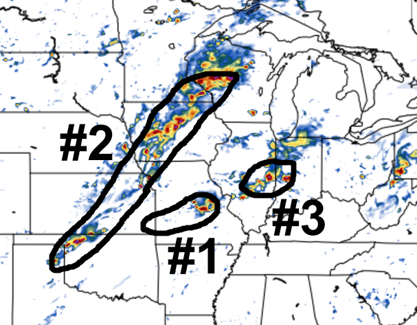
Multiple zones of severe weather will unfold this afternoon/evening across the central U.S. as a potent positively-tilted trough amplifies from the northern Great Plains to the Great Lakes Region by tomorrow (Saturday). Three main zones of severe weather Friday afternoon/evening include: 1. along outflow boundary ahead of cold front from southeast KS through central MO, 2. along main cold front from IA southwest to northwest OK, possibly eastern TX Panhandle, 3. ahead of lead shortwave across southern IL possibly southern IN. In general, strong straight-line winds will be the main threat with any severe weather today, but conditional risk for supercells and isolated tornadoes will be possible particularly in regions 1 and 3, above.
In general, low-level wind shear will remain weak across the warm sector ahead of a textbook September cold front dropping southeast from central Great Plains. However, deep-layer wind shear and instability will be sufficient for storm organization and even supercells with mainly straight-line wind threat along/just east of the cold front, along remnant outflow boundary in southeast KS, and ahead of lead shortwave in southern IL/IN. Storm coverage will be greatest across Iowa this afternoon with the strongest convergence along the cold front coupled with upper-level forcing, but straight-line hodographs, limited instability, and the tendency for storms to be "undercut" by the advancing cold front should mitigate any widespread tornado threat. Despite greater instability to the south along/ahead of the front down through southwest/northwest OK, deep layer wind shear really drops off from KC area southwest which should favor outflow dominant, linear storm evolution.
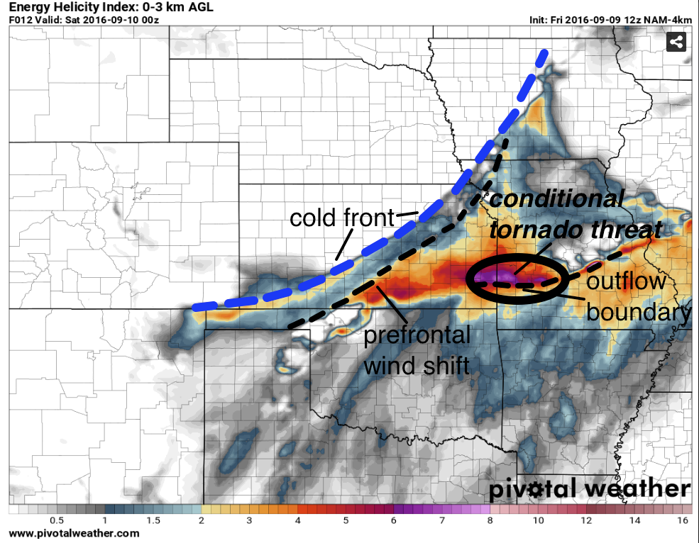
Ahead of the cold front and along an outflow boundary across southeast KS into central/southern MO could be a focus for storm initiation by late afternoon, with a local enhancement of low-level wind shear along and north of this boundary. The HRRR model hints at pre-frontal storms moving from the Wichita area into southeast KS by evening along this outflow boundary, while the 4 km NAM shows supercells farther east along the OFB in central/southern MO. Any supercells that can develop along this OFB will have an isolated tornado threat through evening, but the low- and deep-layer wind shear is still marginal at best in this region.
Another region with isolated tornado potential is ahead of the lead shortwave across southern IL/southwest IN with deep moisture, relatively backed surface winds and 25-30 knots at 850 mb. The presence of supercells to take advantage of this environment is still in question, with short-range model discrepancies in the extent of surface-based storm development here. I do think we'll see a few rotating storms across southern IL into southwest IN by late afternoon.
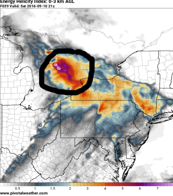
A more significant tornado threat could develop tomorrow (Saturday) afternoon across southern Ontario as a surface low intensifies tonight through tomorrow across the Great Lakes Region. I'll likely be chasing the Great Lakes Region threat tomorrow. Stay tuned.
WarningAware provides a highly customizable service to monitor weather and emergency alerts for businesses and organizations.
Our service can monitor your locations for alerts and send intelligent notifications to both internal and external contacts.
Learn More