Severe Weather Returns to the Northeast U.S. This Afternoon on 1st Day of July!
Dr. Reed Timmer, Lead Meteorologist July 01, 2016
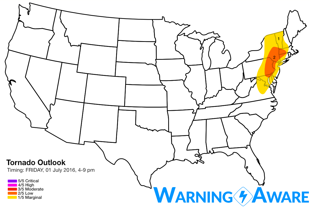
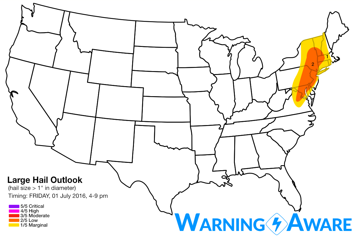
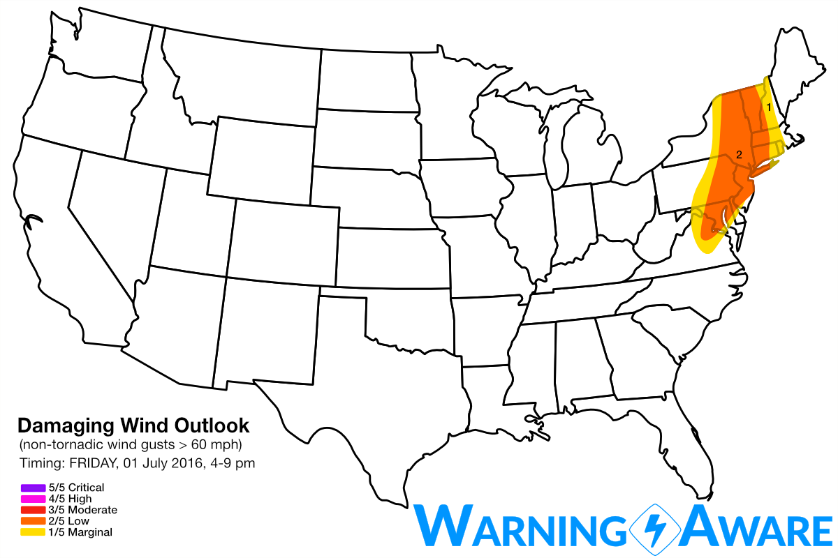
A regionally significant severe weather event appears likely this afternoon and evening (Friday, July 1, 2016) across parts of the Northeast U.S., including the threat for isolated tornadoes. The highest supercell and tornado threat (2/5) will be over northeast PA, northwest NJ, through Upstate NY where the greatest instability and low-level wind shear will overlay. Large hail will also be likely with these same storms, with a larger damaging straight-line wind threat (2/5) covering much of the Northeast from northern VA through western New England. Given strong agreement amongst short-range model guidance on very favorable hodographs/soundings for tornadic supercells this afternoon (3-7 pm EDT) across northeast PA through Upstate NY, I considered issuing a moderate or 3/5 risk for tornadoes and large hail, but decided to hedge on the conservative side.
A potent upper-level trough is digging southeast toward the Northeast U.S. from the Upper Great Lakes Region, inciting a 30-35 knot 850 mb jet within an unstable warm sector across eastern PA through Upstate NY. This LLJ will set the stage for more than favorable wind shear for low-level mesocyclone and isolated tornado formation, especially if the surface winds across this region are relatively backed and out of the SSE or SE by late afternoon.
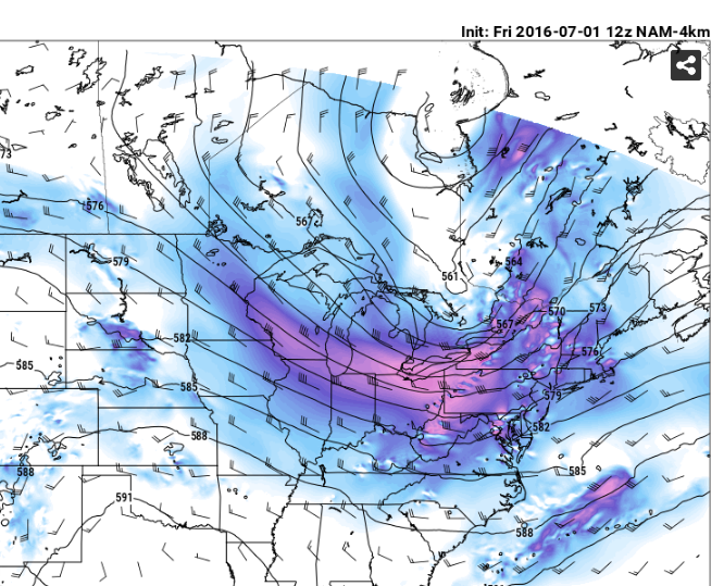
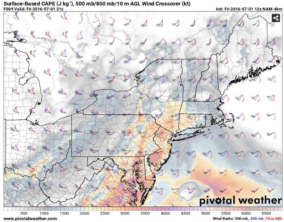
The CAPE, 850 mb and 500 mb wind overlay map for 4 pm EDT this afternoon from the 4 km NAM shows this scenario, with the nose of the greatest instability (surface-based CAPE values near and in excess of 2000 J/kg) reaching to near the Albany, NY area by peak heating. Note the substantial speed and direction wind shear between the surface (10 knots, SSE), 850 mb (30 knots, S), and 500 mb (35-50 knots, SW) across the target area of greatest tornado/hail threat in northeast PA through Upstate NY just to the north of NYC area. I also wouldn't be surprised to see a few renegade supercells in western MA as well just based on climatology. Other models like the HRRR, GFS, etc. are in agreement with the finer scale and synoptic scale features.
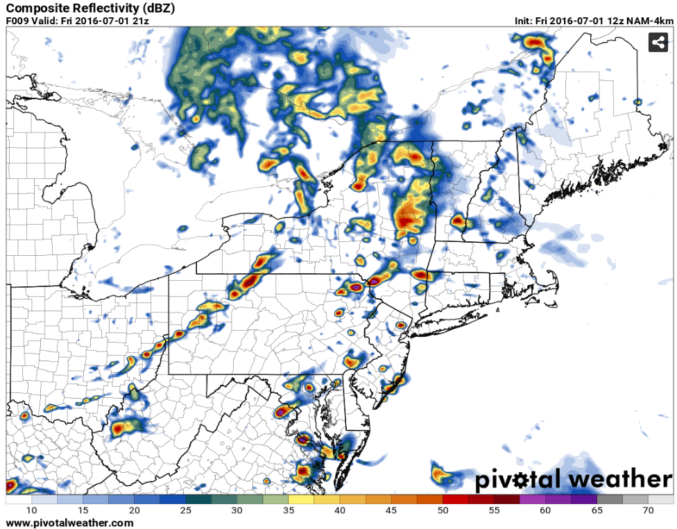
A very cellular storm mode is also indicated by short-range model guidance, with multiple bands of isolated supercells on-going ahead of the cold front across eastern PA to the Albany, NY area by 4 pm EDT. These storms will spread east with a tornado and large hail threat through about 7 pm before merging into a line of storms with damaging straight-line winds the main threat across the rest of the Northeast U.S. from the Mid-Atlantic region to southern Quebec.
The I-95 corridor especially southwest of Boston, including Hartford, NYC, Philadelphia likely will see strong to severe storms by evening but heavy rain and marginally severe straight-line winds will be the main threat with these storms. The tornado threat SHOULD remain to the west of the I-95 corridor, however. Still though a spinner within the complex of storms cannot be ruled out all the way to the Atlantic Ocean. Stay severe weather aware today!
WarningAware provides a highly customizable service to monitor weather and emergency alerts for businesses and organizations.
Our service can monitor your locations for alerts and send intelligent notifications to both internal and external contacts.
Learn More