Extended Period of Significant Severe Weather Likely for the Central/Southern Great Plains!
Dr. Reed Timmer, Lead Meteorologist May 20, 2016
Forecast models are showing potentially over a week straight of severe weather across portions of the southern/central Great Plains from this weekend through at least the end of the week, with tornado and very large hail potential every single day somewhere in the semi-permanent warm sector. Here are detailed outlooks for the first three days (Saturday - Monday, 21-23 May, 2016):
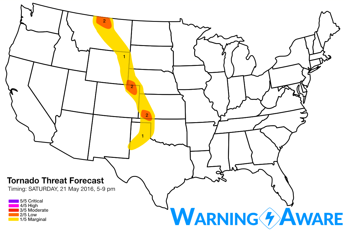
Saturday 21 May 2016
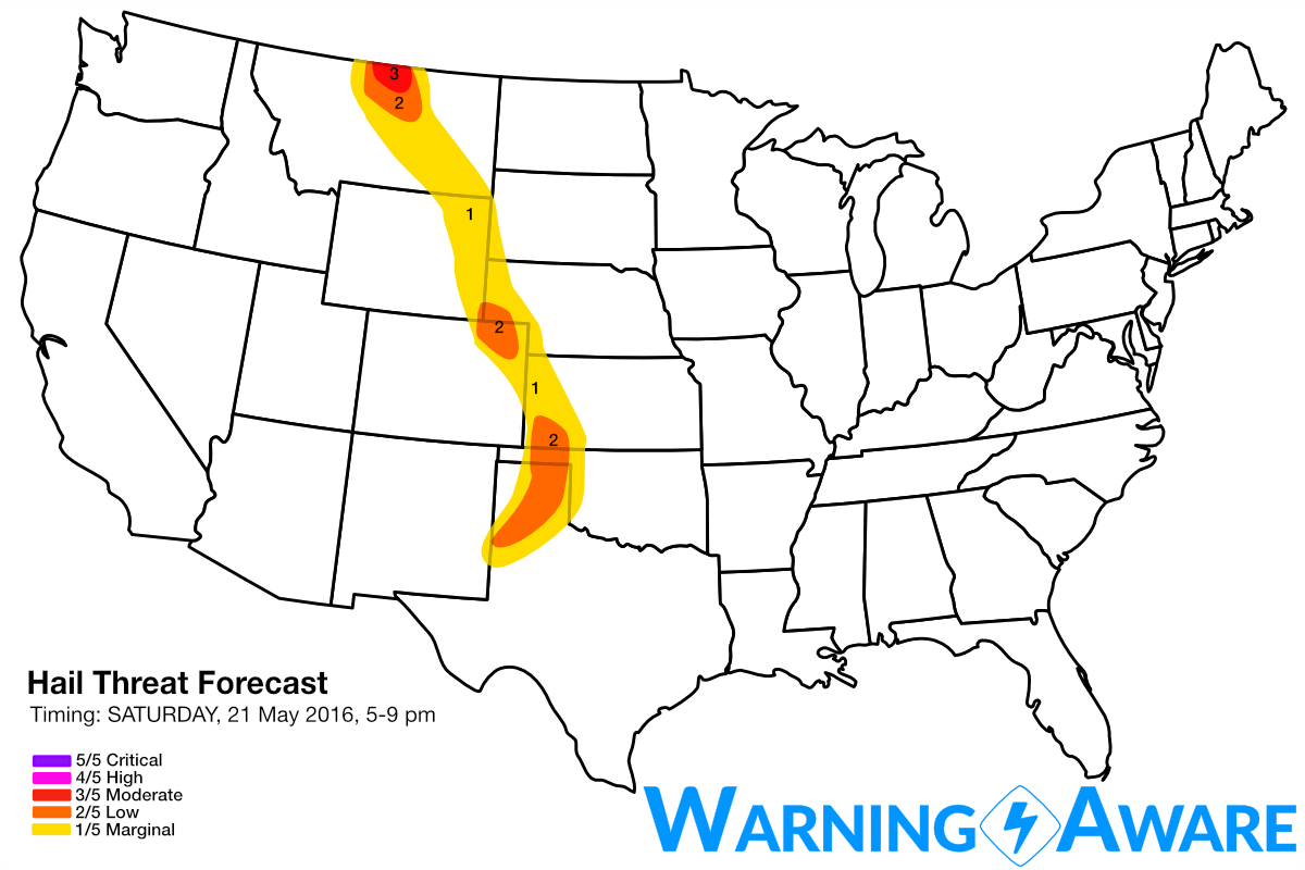
A massive upper-level storm system will still be centered well to the west over the IA/OR border by Saturday afternoon, with modest upper-level flow just sufficient for supercells beginning to overspread portions of the High Plains by peak heating. A narrow nose of deeper moisture will surge north ahead of a dry line from western OK/TX Panhandle with 60F dew points reaching as far as northeast CO by 21z (4 pm CDT), with 50s dew points all the way to southwest Saskatchewan. We predict three areas of relatively greater severe threat on Saturday afternoon/evening: (1) north-central MT into southwest SK, (2) southwest KS, and (3) northeast CO in order of confidence. The greatest storm coverage is expected in north-central MT into southwest SK at the nose of a 50 kt upper-level jet streak and very little cap expected by mid afternoon across all of central MT east of the mountains. The only limiting factor for a greater tornado event in this far northern mode is limited low-level moisture as is typical near the Canada Border this early in the season, but with multiple large-hail producing supercells expected in north-central MT/southwest SK starting after 3-4 pm, have gone with a moderate or 3/5 hail threat in this region.
Upper-level dynamics and confidence in initiation decrease to the south, with a strong cap limiting convection overall for most of the day on Saturday across the High Plains. Relatively greater storm coverage may exist in the Texas Panhandle with greater heat/moisture, but large hail will be the main threat with these storms as the greater wind shear will reside to the north. Any supercells that do from in the narrow moisture axis from southwest KS NNW to northeast CO will have the potential to produce isolated tornadoes and large hail, with most high-resolution models initiating a lone supercell in southwest KS near the Liberal to Garden City area. While confidence is not as high in storms initiating in this environment Saturday afternoon, we've still issued a 2/5 tornado threat for southwest KS and northeast CO respectively. These two locations have relatively greater likelihood for surface-based supercells within a strongly capped warm sector.
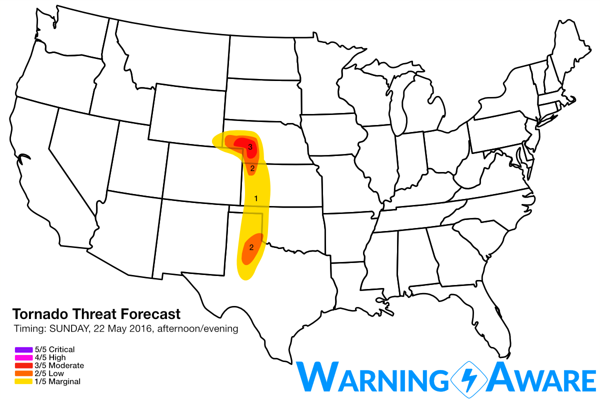
Sunday (22 May 2016)
By Sunday, the center of the large-scale upper low lifts north into Alberta as the high-amplitude trough axis swings to the east toward an unstable warm sector in place across the High Plains (with another day of moisture return). With 50-75 knot 500 mb flow along the trough axis from the southern High Plains through the Dakotas, supercells will be possible with any convection within this large warm sector. The greatest threat for large hail and tornado producing supercells will be where the greatest low-level wind shear and instability coincide - extreme northwest KS into the southern Nebraska Panhandle. We have included this region in a moderate or 3/5 threat for tornadoes and large hail, accordingly. A southern mode of enhanced severe weather appears likely Sunday late afternoon/evening across parts of northwest Texas where the greatest instability will be found, with surface-based CAPE values exceeding 4000 J/kg here east of the dry line. Despite overall weaker low-level and deep layer shear, the greater instability could compensate for the kinematic limitations and dominant supercells could develop a tornado threat, especially near sunset from Childress area down to east of Lubbock, TX.

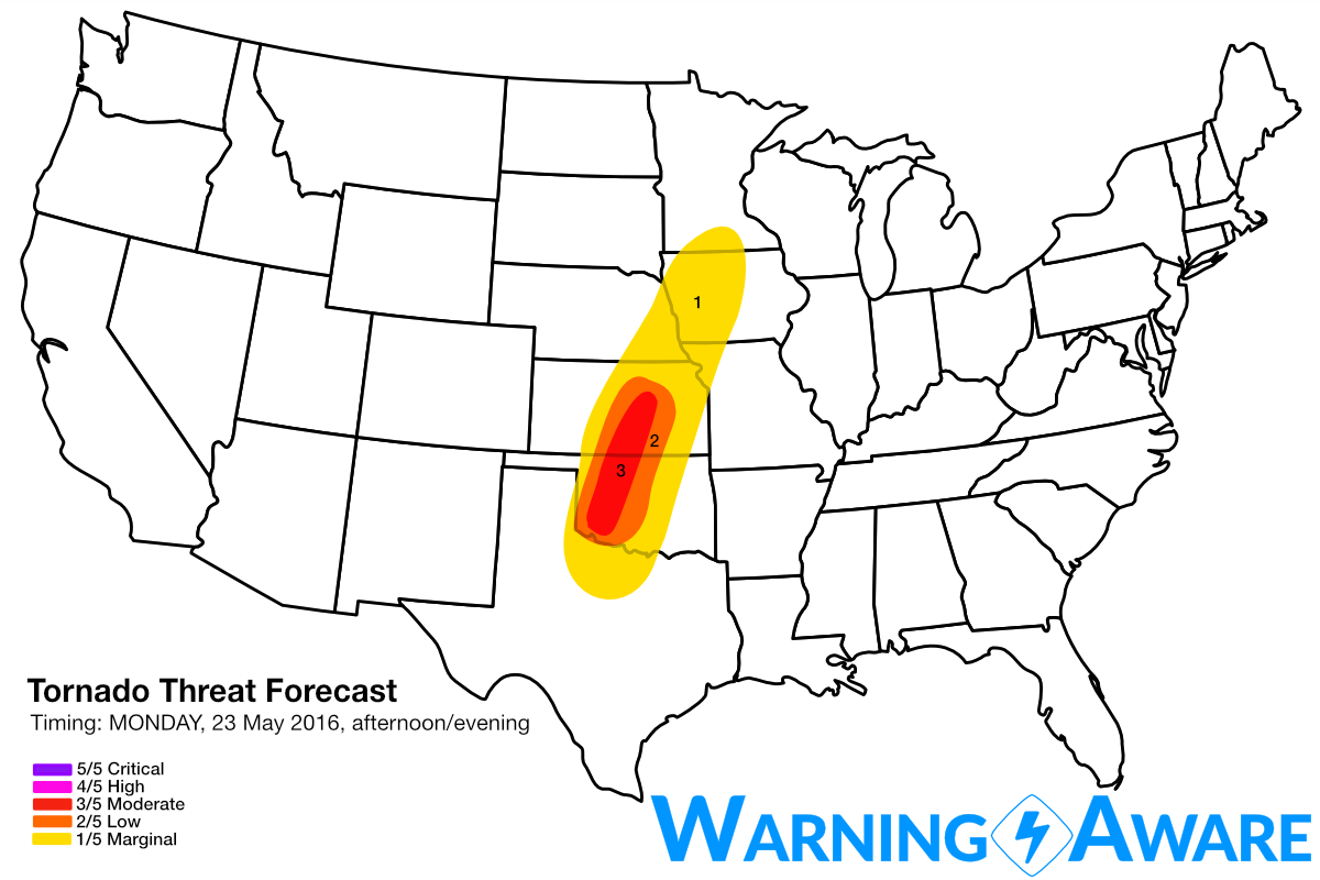
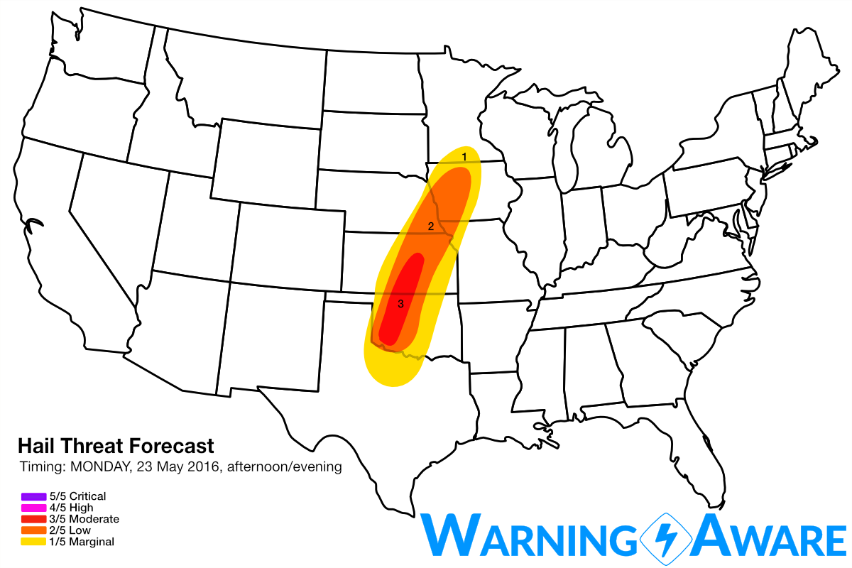
Monday (23 May 2016)
Dew points are forecast to rise into the low 70s east of a sharp dry line across northwest Texas, western OK, into southern KS as a large-scale trough builds in the western U.S. behind the lead wave, resulting in EXTREME instability in this region. With wind shear more than sufficient for supercells and tornadoes especially across central KS into western OK, strong tornadoes will be possible here especially near sunset as the low-level jet stream ramps up We've issued a large moderate (3/5) category for tornado and large hail threat for this region with a likely upgrade if the forecast models hold over the next few days.
Beyond Monday, multiple days of severe weather with tornado and large hail potential appear likely across the same areas through the end of the week, but is still too far out to pin-point more detailed target areas. Stay tuned.
WarningAware provides a highly customizable service to monitor weather and emergency alerts for businesses and organizations.
Our service can monitor your locations for alerts and send intelligent notifications to both internal and external contacts.
Learn More