Severe Weather Threat Today Is Focused Across Deep South Texas
Dr. Reed Timmer, Lead Meteorologist May 19, 2016
A very slow moving cold front re-enforced by morning storms will become nearly stationary today across deep South Texas from just south of Laredo through north of Corpus Christi, and will be the focus of a severe weather and flash flooding threat there through this evening. Elevated strong to severe storms are already propagating along and just north of the cold front/outflow boundary with the strongest cells near Freer and east of Beeville, TX as of 1130 am CDT, with a severe thunderstorm warning in effect for the latter cell for winds over 60 mph. The storm currently near Freer, TX will have the potential to become surface-based this afternoon as it moves east along the front, and could even develop isolated tornado potential.
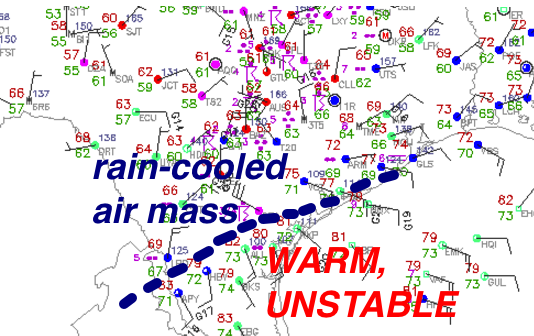
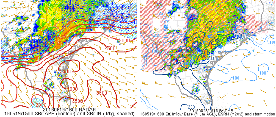
Temperatures have risen into the low to mid-80s with dew points in the lower 70s to the south of the front, with zero convective inhibition shown by the latest RAP analysis. Surface-based CAPE values exceeding 2500 J/kg are analyzed along and south of the boundary in South Texas, with effective helicities exceeding 200 m2/s2 already. Low-level and deep layer wind shear will only increase toward late afternoon/evening along and south of the stationary front, with isolated tornado potential with any storms that become surface-based.
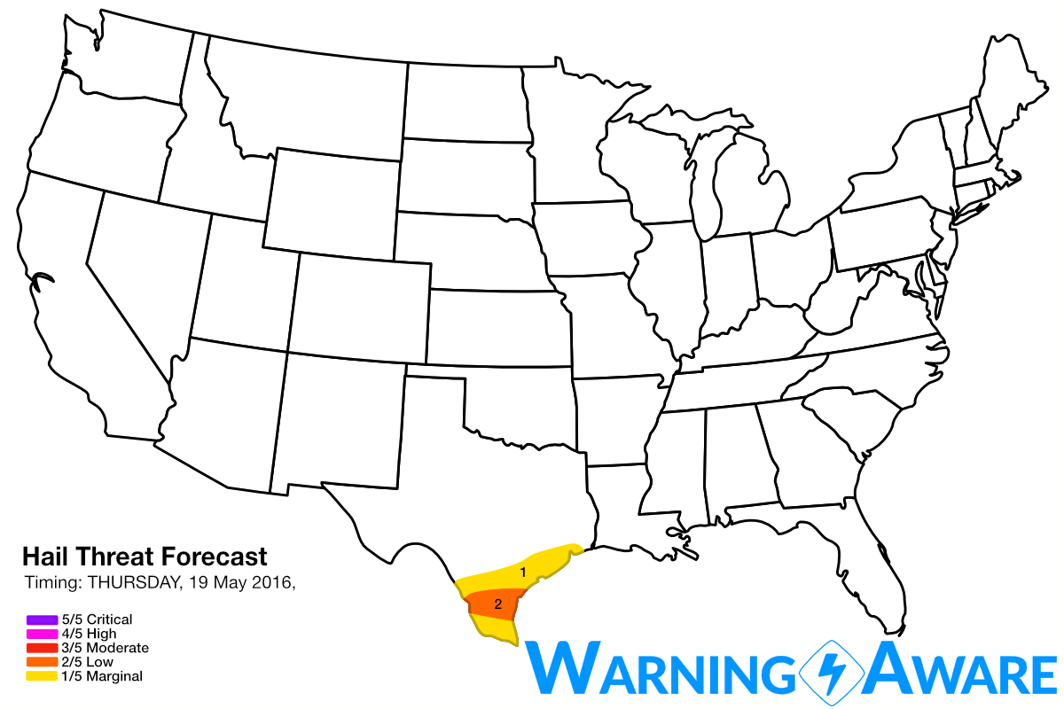
The greatest tornado and large hail potential will be with any storms that become surface-based along the soon-to-be stationary front from south of Laredo through the Corpus Christi, TX area, and with any isolated supercells that can form in the unstable, relatively strongly sheared environment south of the boundary from the Brownsville to Corpus Christi, TX areas. Radar imagery is already showing isolated convection trying to form in this corridor late this morning, and a few of these could develop into supercells through afternoon. I wouldn't be surprised to hear of water spouts through evening with any of these "renegade" cells that mature in the warm sector along the South TX Coast. Despite an environment that is quite conducive for tornadoes in South Texas this afternoon, have decided to stay with a low (2/5) threat for tornadoes and large hail across this region because confidence is still low in the number of dominant surface-based storms that can take advantage of this environment. It is likely that a massive mesoscale convective system will form along this boundary and clean out the warm sector.

The severe weather threat returns to the central/southern High Plains as early as Saturday, with significant severe weather possible by at least Sunday and Monday across parts of the southern Plains as a large-scale trough amplifies across the western U.S. Stay tuned.
WarningAware provides a highly customizable service to monitor weather and emergency alerts for businesses and organizations.
Our service can monitor your locations for alerts and send intelligent notifications to both internal and external contacts.
Learn More