Large Hail Possible by Late Afternoon/Evening for Parts of Eastern Carolinas!
Dr. Reed Timmer, Lead Meteorologist May 03, 2016
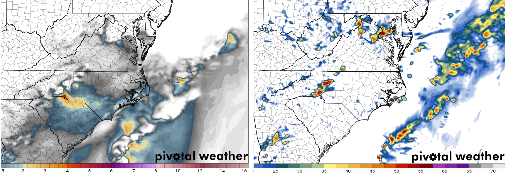
Based on latest high-resolution forecast model trends, we've decided to add a low (2/5) severe hail threat category for parts of the SC/NC Carolina Piedmont region east of the Appalachian Mountains for this late afternoon and evening. Skies have cleared behind initial storms currently moving off the NC Outer Banks, with temperatures in the low-to-mid 70s and dew points as high as the upper 60s contributing to surface-based CAPE values already in excess of 1000 J/kg. Given strong deep layer wind shear, storms will initiate off the higher terrain and quickly become supercellular especially near the NC/SC border region in the western part of the hail risk area below. Both the 4 km NAM and HRRR show initiation along pre-frontal trough by 3 pm, with a cluster of likely severe storms moving toward the eastern NC/northeastern SC coast by near/after sunset this evening.
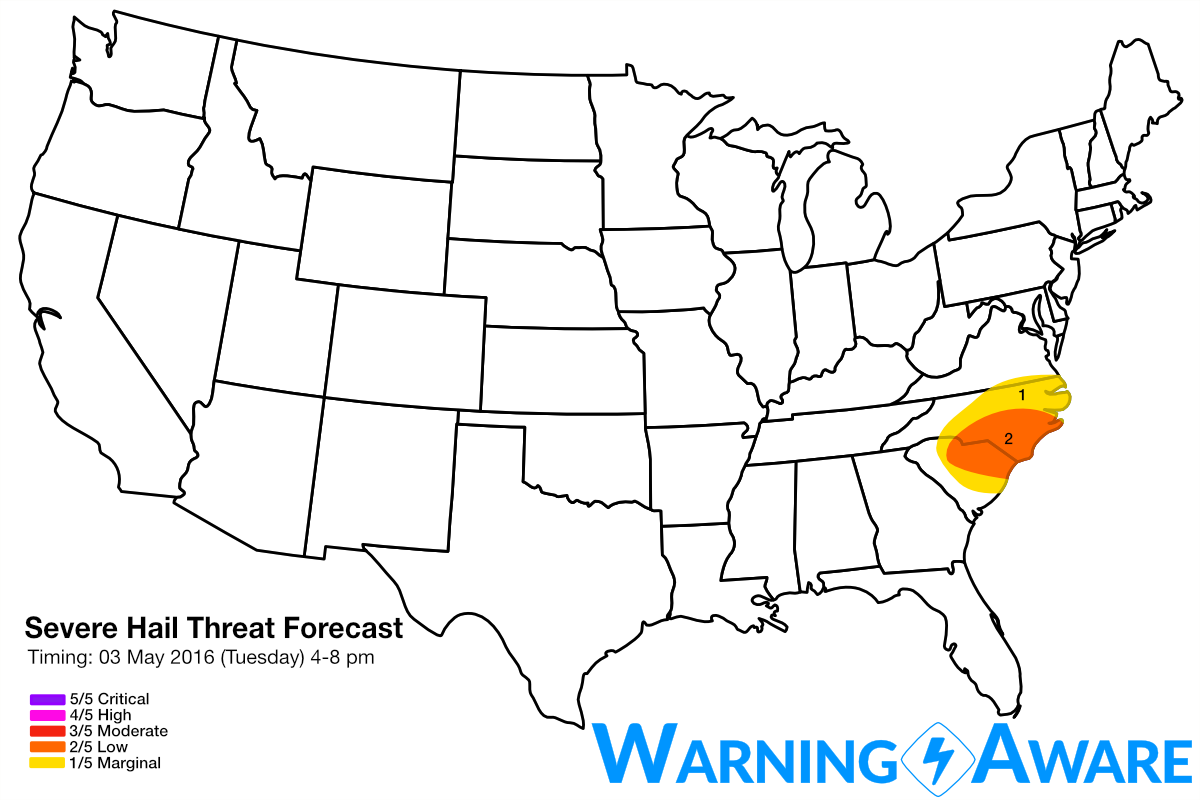
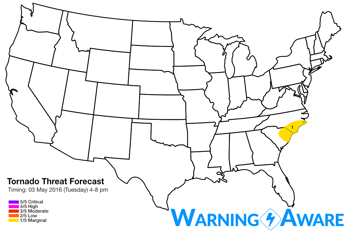
Given cold temperatures aloft associated with a large-scale eastern U.S. trough and seasonably warm/moist temperatures at low levels ahead of the front, and the presence of sufficient deep-layer shear for supercells, large, damaging hail is possible with the dominant storms especially along the SC/NC border into southeast NC by evening. Low-level shear appears very weak with a marginal LLC, so the tornado threat will be very marginal, but still non-zero.
The next major severe weather threat looks to be for the central/southern Great Plains especially on Sunday-Monday, with yet another cut-off upper level storm system. Stay tuned..
WarningAware provides a highly customizable service to monitor weather and emergency alerts for businesses and organizations.
Our service can monitor your locations for alerts and send intelligent notifications to both internal and external contacts.
Learn More