Big Severe Weather Likely next Week in the Southern Great Plains!
Dr. Reed Timmer, Lead Meteorologist April 21, 2016
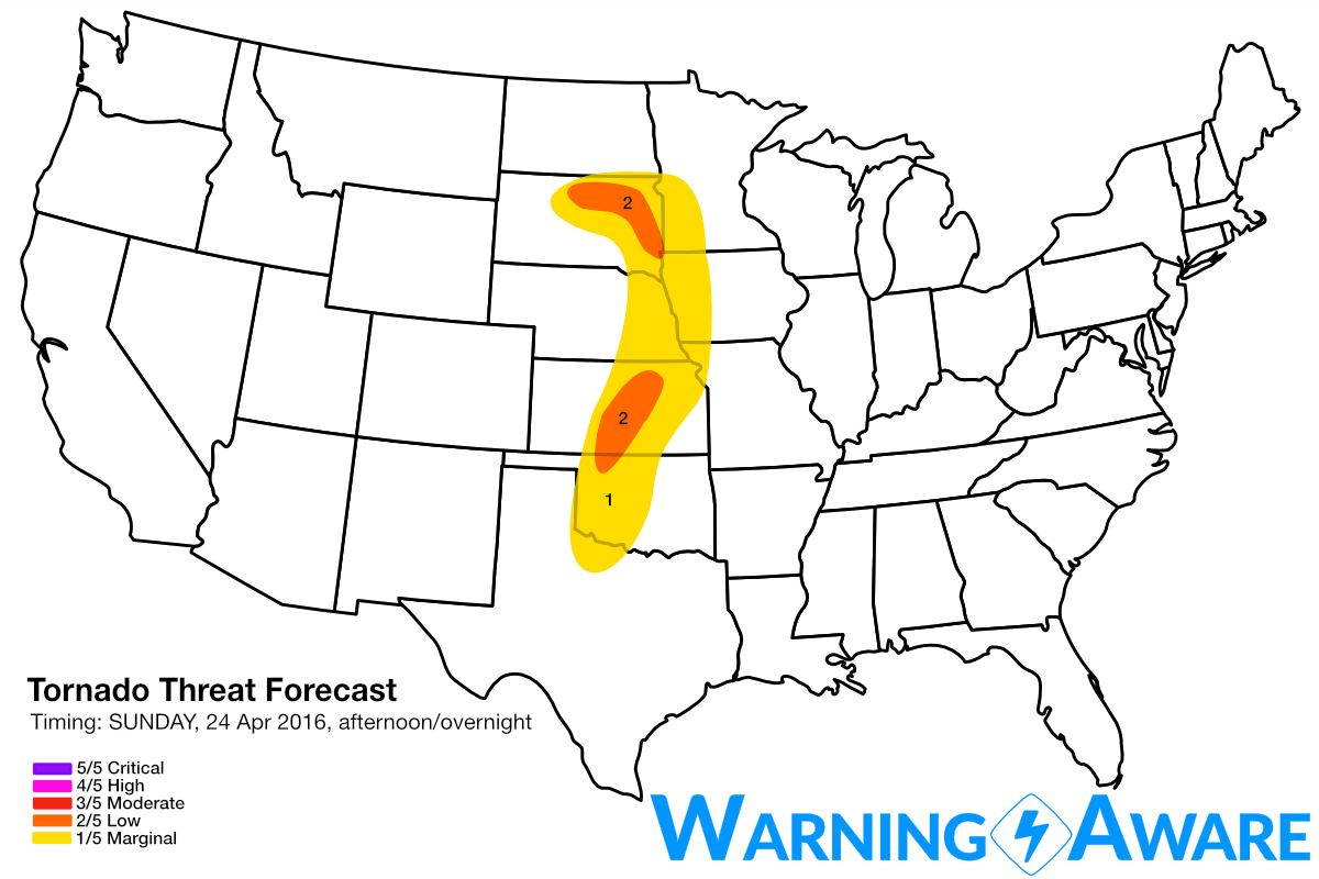
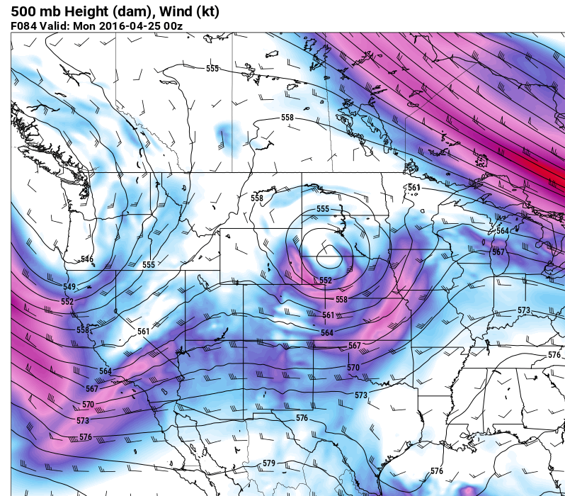
An extended period of severe weather appears likely next week across the southern Great Plains and other parts of the central/southern U.S., starting as early as Sunday afternoon/evening from eastern SD through western OK. A major pattern shift is underway from the stagnant omega block regime we have been experiencing for several days, with a large-scale, high-amplitude trough about to build across the western U.S. by early next week. Several significant shortwaves will rotate around the base of the large-scale trough, the first of which will eject across the central Plains on Sunday. Since moisture return from the Gulf will just be getting started again, and the best dynamics with the lead wave appear to be over the Dakotas, I don't think Sunday will be a very significant event. But a lot can change in the forecast models between now and then. If the current model runs are accurate, I could see an arc of supercells with isolated tornadoes just east of the surface low across eastern SD by Sunday afternoon, and a southern mode of enhanced severe weather somewhere across the southern Plains along/east of the dry line, likely in KS/OK.
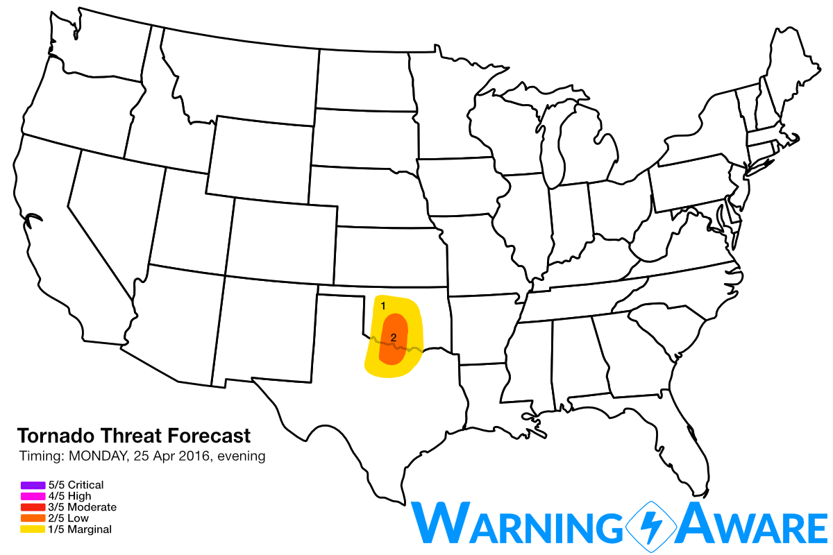
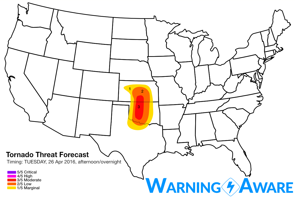
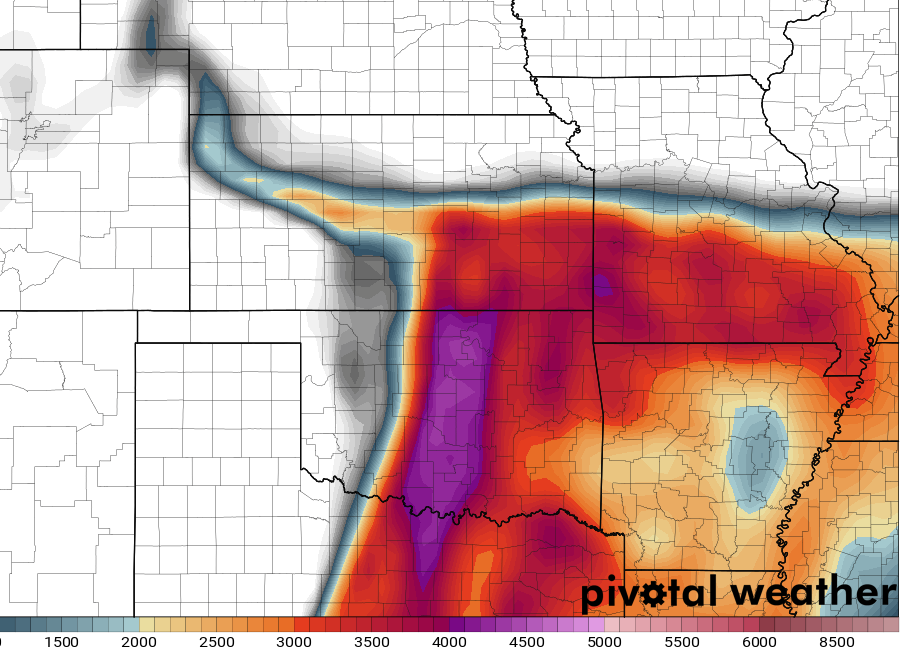
Keep in mind that we are still 4-5 days before the severe weather event(s), so all of these forecasts are highly subject to change as we progress through the week. Monday looks to be more of a moisture-transport day, with the next upper-level trough still well to the west over the 4-corners Region, but there still is a small chance for severe weather/supercells along the dry line in OK/North TX if surface convergence is sufficient. TUESDAY looks to be a very significant severe weather day with a textbook southern Plains dry line setup as another main upper-level trough ejects, including supercell/tornado potential in KS, central/western OK, north Texas. The environment east of the dry line in the southern Plains will be characterized by strong instability and high low-level and deep layer wind shear, perfect for long-track tornadic supercells. Again there is no need to panic, as a lot can change in the forecast models between now and then, but current forecast model consistency is relatively high with significant severe weather on Tuesday afternoon - overnight in the southern Plains.
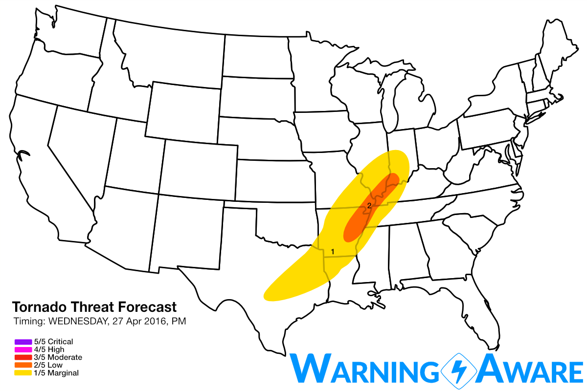
By Wednesday, the upper-level trough ejects east of the Great Plains, with less significant severe weather possible along a cold front from southern IL/IN all the way south to east Texas. However by this far out in the period, the forecast confidence is much lower and highly sensitive to the timing/evolution of this potent upper-level storm system. Stay tuned for frequent and likely changing forecast updates through the weekend leading up to an active severe weather period next week.
WarningAware provides a highly customizable service to monitor weather and emergency alerts for businesses and organizations.
Our service can monitor your locations for alerts and send intelligent notifications to both internal and external contacts.
Learn More