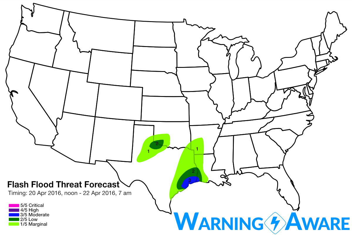
Flash Flood Threat Returns for Houston, TX Area This Afternoon!
Dr. Reed Timmer, Lead Meteorologist April 20, 2016
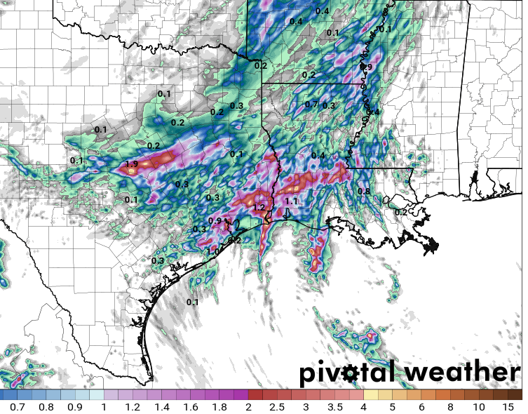
While not nearly as significant as a few days ago, it looks like heavy rain and a flash flood threat will return to the Houston, TX area starting in a few hours, and continuing through afternoon. High-res models are suggesting a regeneration of convection/storms along outflow that is sagging south toward the Gulf Coast. There could be some training of these storms through 5 or 6 pm across the Houston area, with the HRRR showing over 2" additional rain especially just to the north. With river and bayou flooding still a major problem from the historic rains a few days ago, have introduced a moderate (3/5) flash flood threat for the Houston area as it won't take much additional rain to cause more problems.
 Model imagery by: pivotalweather.com
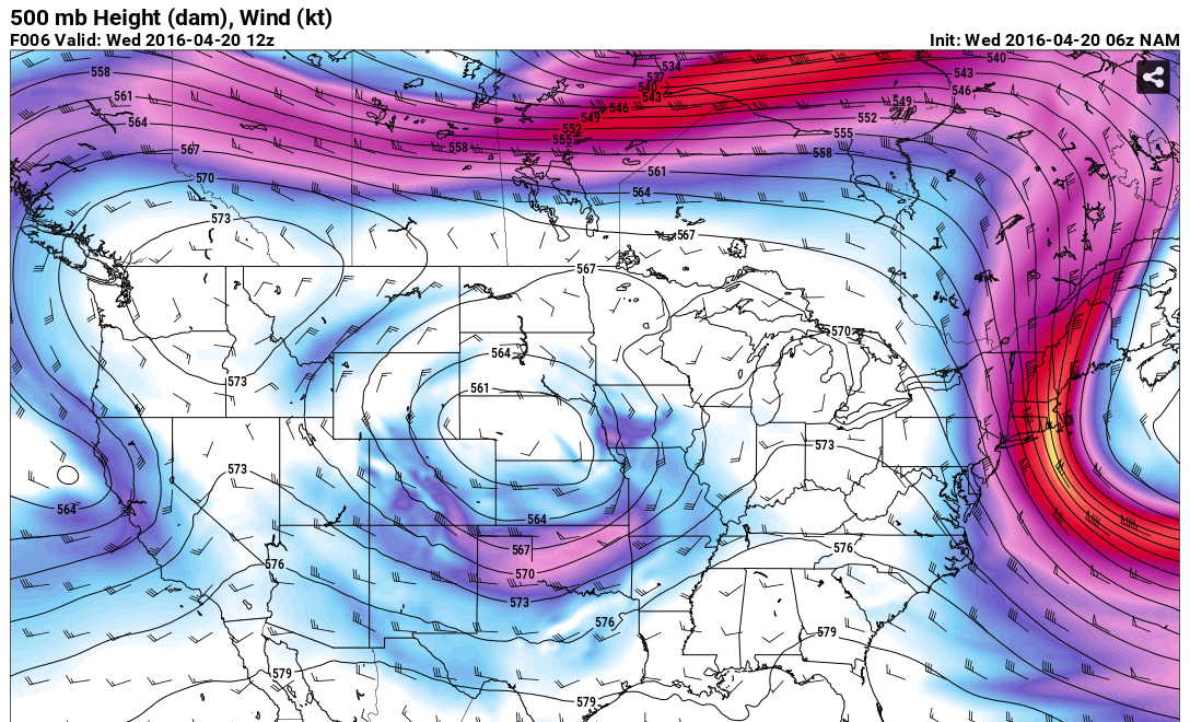
A textbook omega block is in place across North America with the Polar Front Jet Stream, with the responsible upper-level storm system trapped underneath over the Southern Plains. This upper low is forecast to drift slowly southeast toward the Lower Mississippi River Valley by the end of the week, bringing with it the flood threat. A subtle jet streak rotating around the backside of this upper-level low this evening will also trigger additional severe storms across the southeast Texas Panhandle by 6-7 pm. Strong deep-layer shear will support supercell storms and a large hail threat across the southeast TX Panhandle into Northwest Texas this evening, but very weak low-level shear should mitigate any robust tornado threat. Since these storms likely will congeal into a heavy rain-producing MCS tonight near and just south of the Red River in Northwest TX, we've added a 2/5 category for flash flood threat here for overnight.
 Model imagery by: pivotalweather.com
The long-range forecast is looking VERY interesting for the southern Plains, with severe weather and tornadoes possible nearly every day from Sunday through the end of next week. I'll be posting a special discussion tonight or tomorrow morning on this long-range severe weather threat. It looks like the spring storm season is really going to ramp up to close out the month of April.
WarningAware provides a highly customizable service to monitor weather and emergency alerts for businesses and organizations.
Our service can monitor your locations for alerts and send intelligent notifications to both internal and external contacts.
Learn More