Flash Flood Threat Shifts to Red River Region Tonight!
Dr. Reed Timmer, Lead Meteorologist April 19, 2016
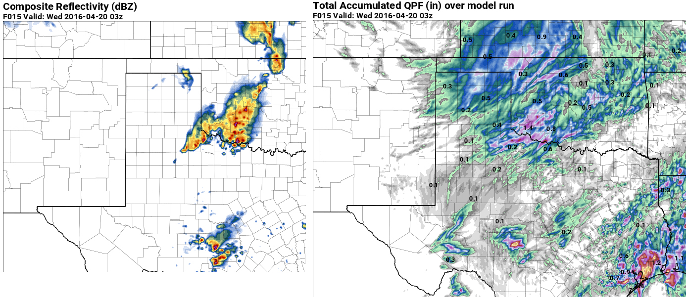
A near stationary upper-level low will continue to spin over Colorado today, before drifting slowly toward the central Plains tomorrow, with more flash flood potential across parts of the southern Great Plains. The upper low then drops southeast toward the Lower Mississippi River Valley by Friday bringing with it the flood threat. While the rivers and bayous in the Houston area are still well above flood stage, the heavy rain potential and flash flood threat shifts to northwest Texas and southwest Oklahoma tonight through tomorrow morning. Storms are forecast to develop in northwest Texas late this afternoon/evening and quickly congeal into a mesoscale convective system that will propagate slowly across southwest Oklahoma down through the Red River region. Most forecast models show around 2" of rain with this MCS from northwest TX to just southwest of the OKC Metro by tomorrow morning, but I wouldn't be surprised to see rainfall totals much higher than that near or just north of the Red River. Since this rain will be falling on ground already saturated from rainfall a few days ago, have introduced a moderate (3/5) threat for flash flooding in this region tonight through Wednesday AM.
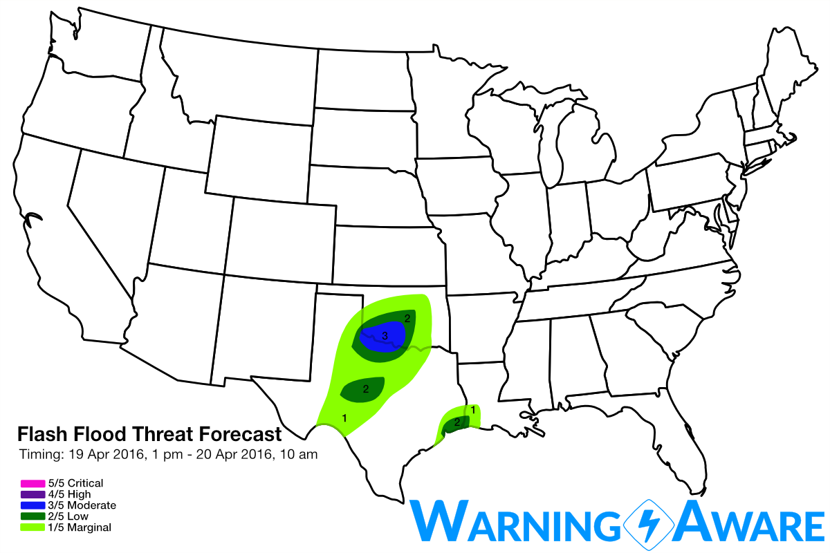
High-res models have also shown a band of heavy rain producing storms near and just east of Houston by early this afternoon, but so far, this convection has not materialized with the robustness shown in the 4 km NAM, HRRR, etc. For this reason, but since it will only take a very small amount of rain in this watershed to see more flash flooding, have included Houston to Lake Charles in a low-end (2/5) threat for flash flooding. But realizing that the river/bayou flooding is an ongoing and major problem regardless of any new rainfall.
 Model imagery by: pivotalweather.com
Forecast models are also consistent in firing slow-moving storms by late afternoon to the west across the southern Texas Hill Country, but with much more isolated storm coverage as compared to the Red River Region this evening/overnight. Still though, any areas that happen to be hit by one of these slow-moving, heavy rain producing storms will have locally much higher threat for flash flooding. After-all, this region has come to be known as "Flash Flood Alley" for a reason. Stay tuned to local flood statements.
The southern Plains will finally start to dry out by Thursday as the upper-low finally moves to Dixie Alley. The next major severe weather threat looks to be the middle of next week across the Plains, once again.
WarningAware provides a highly customizable service to monitor weather and emergency alerts for businesses and organizations.
Our service can monitor your locations for alerts and send intelligent notifications to both internal and external contacts.
Learn More