Forecast Discussion for Southern High Plains Severe Weather Threat on Friday/Saturday
Dr. Reed Timmer, Lead Meteorologist April 13, 2016
Severe weather will be on the increase again on Friday and Saturday afternoon/evening, but this time across portions of the High Plains. An upper-level storm system will cut off as a massive ridge forms in the Polar Front Jet Stream across western North America, and slowly drift east across the southern Rocky Mountains toward the end of the week. With sea surface temperatures in the Gulf of Mexico still below normal, likely in part due to recent southward penetrating cold fronts, the moisture return will not be very robust ahead of this system. Relatively low dew points especially on Friday afternoon will be the main limiting factor for a much more significant severe weather and tornado threat in the southern High Plains.
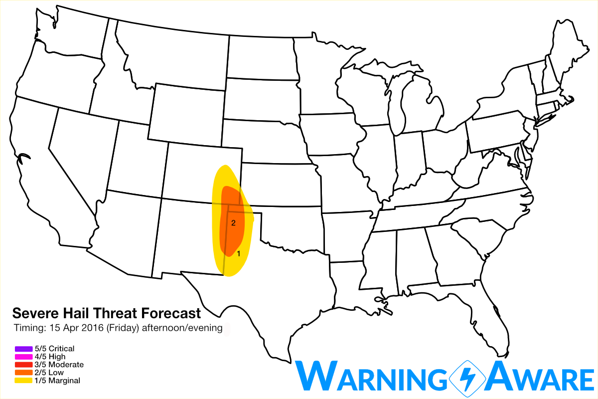
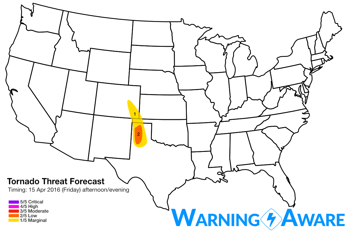
I've introduced a low (2/5) severe hail threat for Friday afternoon/evening across the central/western Texas Panhandle into southeast Colorado, including locations like Amarillo, TX; Guymon, OK; and Springfield, CO. High-based hail producing supercells should develop in eastern NM and off the mountains in southeast CO by mid to late afternoon, and slowly mature as they move east into the western Panhandle region by evening. Since the very cold air aloft will still be well west of the High Plains on Friday, I've decided not yet to introduce a more significant hail threat for Friday afternoon. But given the anticipated supercellular storm mode, I'll probably end up bumping this region to the moderate (3/5) category for hail. Since dew points will likely remain in the upper 40s, possibly barely exceeding 50F in the Panhandles, I'll likely maintain a marginal tornado threat for this region. I wouldn't be surprised to see several brief tornadoes in eastern CO on Friday, however, as often is the case with these High Plains setups with marginal moisture.
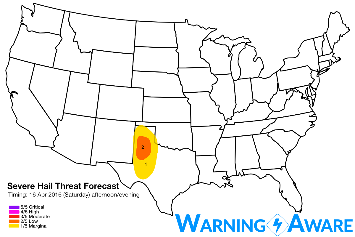
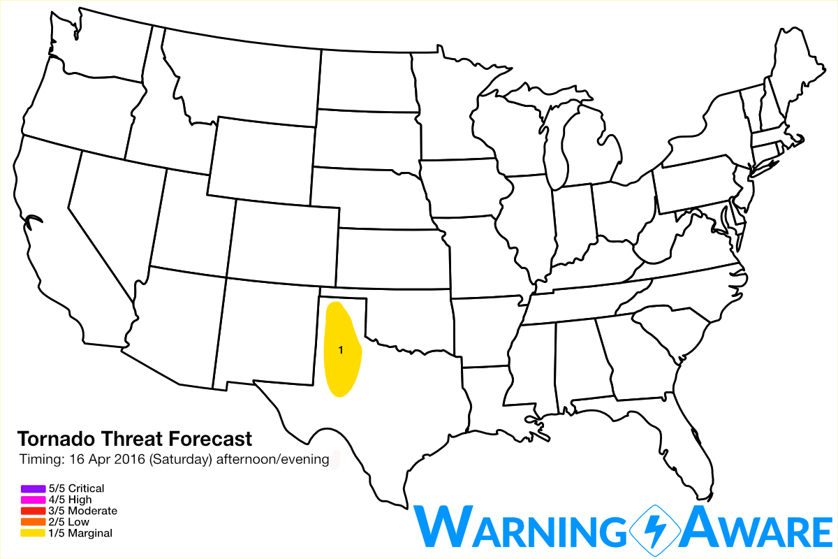
Similar areas will experience a severe weather threat on Saturday afternoon/evening as well, but slightly south from the Friday risk areas. With another day of moisture return for this system, I could foresee the Saturday hail/tornado threats being upgraded, but at this point it is still too far out to make that call with any confidence. There also could be severe weather in South Texas again on Sunday as the cut-off upper-level low sags southeast, and then the massive ridge with an omega block ushers in a lengthy period of quiet, nice weather for next week.
Stay tuned, as I'll continue to update these hail/tornado threat maps up until I arrive in my chase target area on Friday afternoon.
WarningAware provides a highly customizable service to monitor weather and emergency alerts for businesses and organizations.
Our service can monitor your locations for alerts and send intelligent notifications to both internal and external contacts.
Learn More