More Widespread Severe Weather Event Expected Tomorrow for Much of Arkansas, Southeast Oklahoma, Extreme Northeast Texas
Dr. Reed Timmer, Lead Meteorologist April 10, 2016
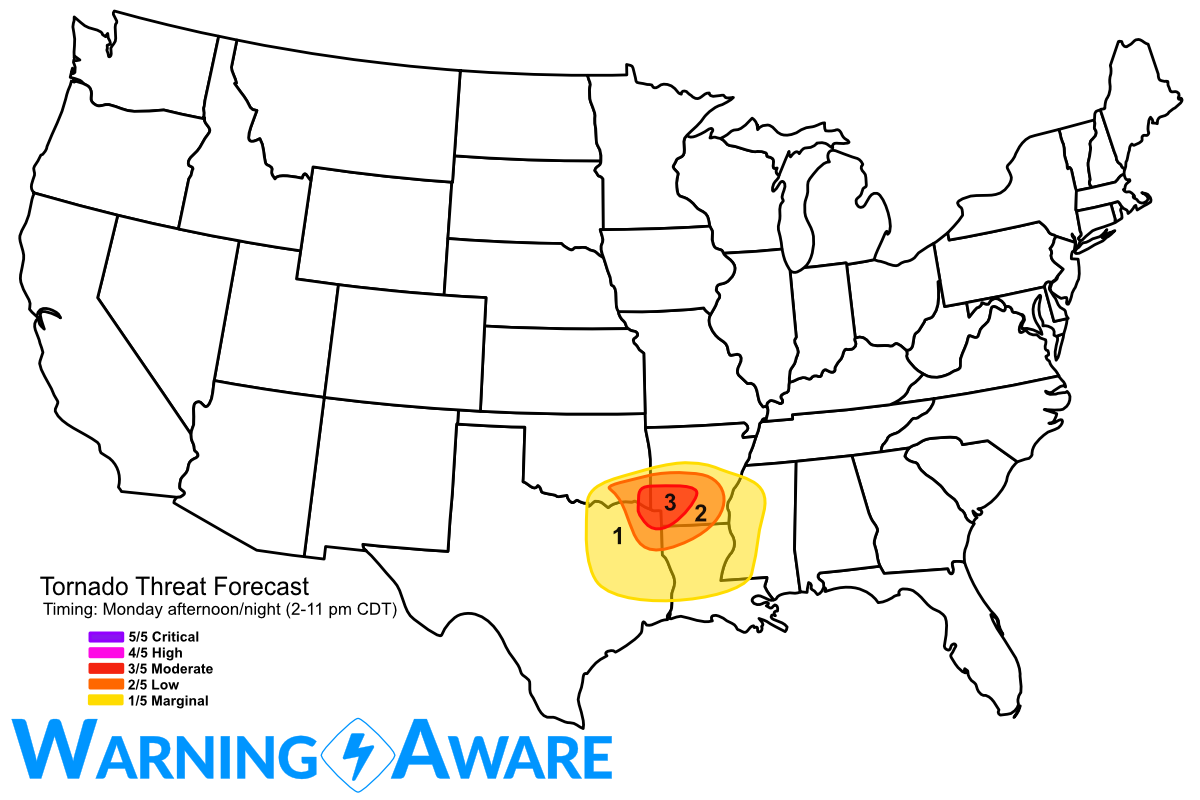
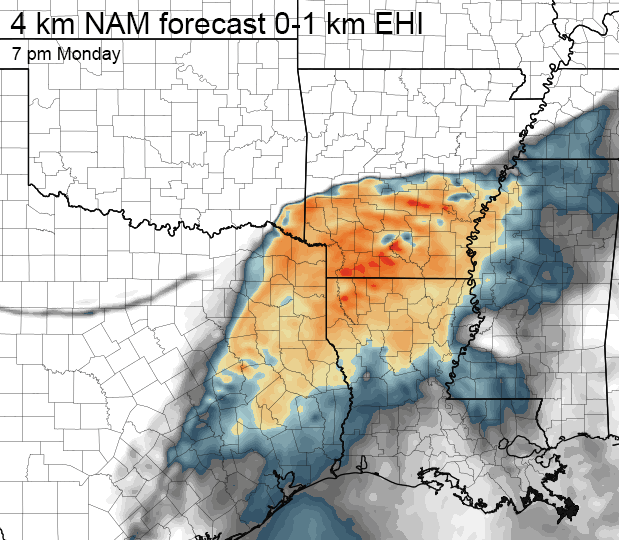
A more widespread severe weather event is expected to unfold tomorrow (Monday) afternoon and evening across southeast Oklahoma, central/south Arkansas, extreme northeast Texas, possibly as far south as northern Louisiana, with much greater storm coverage as compared to Sunday in the southern Plains. Large hail is expected to be the main threat, with some very large hail to baseball size with the more dominant supercells especially in southwest Arkansas. A moderate tornado threat is expected to develop especially with any prefrontal supercells in the strongly sheared, unstable environment over southwest Arkansas, extreme southeast Oklahoma, possibly northeast Texas but storm coverage to the south is still in question.

A surface low is expected to track across southeast Oklahoma approaching the southwest Arkansas border by 7 pm Monday evening with surface winds backing to the east across southwest Arkansas. Hodographs look most favorable for tornadoes by Monday late afternoon/evening just ahead of this surface low in the vicinity of these backed winds, so any supercells that approach from the southwest developing near the ArklaTex region will likely become tornadic as they move into southwest Arkansas. The time window with greatest tornado risk in this region is between about 4/5 pm and 10 pm, but I wouldn't be surprised to see a few early afternoon tornado warnings to the north along the front in southeast OK into west-centra AR. A strong cold front will overtake the triple point and surge southward overnight with storms congealing into a squall line.

I'll likely be heading toward an initial target area of Texarkana tomorrow, before likely heading north into the dense forest/hills of southwest Arkansas. Stay tuned for updates from the field.
WarningAware provides a highly customizable service to monitor weather and emergency alerts for businesses and organizations.
Our service can monitor your locations for alerts and send intelligent notifications to both internal and external contacts.
Learn More