Supercell, Tornado Potential to Increase After Sunset in Southwest OK/Northwest TX
Dr. Reed Timmer, Lead Meteorologist April 10, 2016
Latest high-resolution forecast models have been trending toward an enhanced tornado threat near and especially just after sunset across extreme southwest Oklahoma. Storms will develop initially by late afternoon along the dry line in the eastern Texas Panhandle with large hail the main threat. Low-level wind shear should be initially weak throughout the warm sector before sunset, but decent upper-level winds will support high-based supercell potential early on. The tornado threat will develop with any dominant supercell storms that approach the OK/TX Panhandle border after sunset once the low-level jet begins to re-intensify. 0-1 km storm relative helicities will skyrocket above 200 m2/s2 by 9-10 pm over southwest OK into extreme northwest TX, even supported an isolated strong tornado potential for a short time-window through about 11 pm. The supercells will likely congeal into a weakening complex of strong-severe storms as they approach the OKC Metro around midnight.
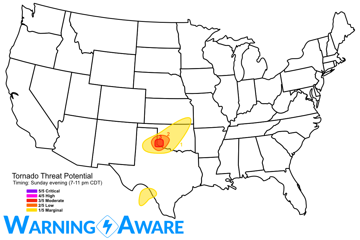
There is also a threat for severe weather especially in northeast Mexico west of the Del Rio, TX area. Storms should fire off the higher terrain by late afternoon in Mexico and approach the Rio Grande River after sunset. Large hail and heavy rain will be the main threat with these storms, but we'll likely never know what happens in terms of tornadic activity with these storms on the Mexico side.
The severe weather/tornado threat focuses over the Arkansas/Texas/Oklahoma border region on Tuesday. Stay safe out there and make sure those weather radios are charged up.
WarningAware provides a highly customizable service to monitor weather and emergency alerts for businesses and organizations.
Our service can monitor your locations for alerts and send intelligent notifications to both internal and external contacts.
Learn More