ARCTIC BLAST to Dominate Northeast U.S. For the next Week!
Dr. Reed Timmer, Lead Meteorologist April 02, 2016
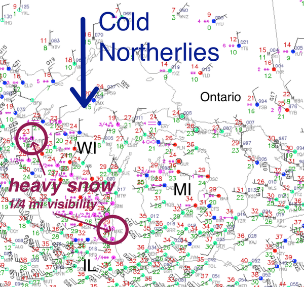
The Arctic Blast is well underway across the Great Lakes Region this Saturday morning with temperatures plunging into the 20s and even upper teens across Wisconsin and northern Michigan, with heavy snow and visibilities less than 1/4 mile reported at Milwaukee and Hayward, WI in the last hour. Thunder and lightning will be possible with the heavier convective snow squalls this afternoon throughout the Great Lakes Region, and with the frontal passage tonight across the rest of the Northeast U.S. I’ll be out chasing the thundersnow and big-time wind potential along the Arctic Front in the Northeast tonight from NYC through coastal Connecticut.
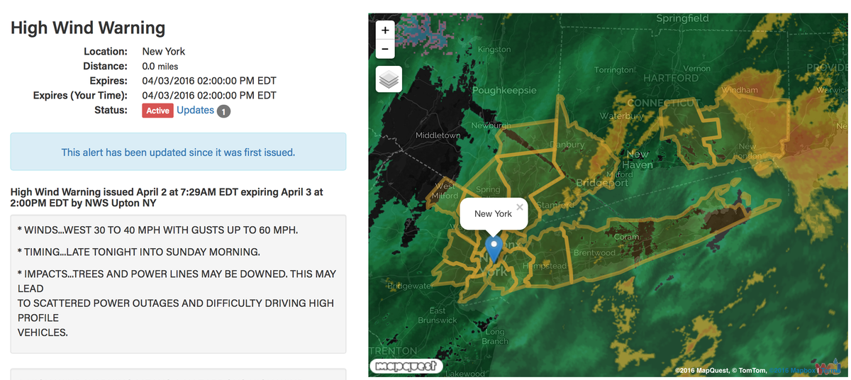
A HIGH WIND WARNING has been hoisted for parts of the Northeast including Philadelphia, New York City, Long Island with a high wind watch from Providence through Boston, where wind gusts of 50-70 mph are possible late tonight through Sunday morning! Boston NWS even mentions wind gusts to hurricane force across exposed areas of Rhode Island through southeast Massachusetts with thunder snow. Very steep lapse rates with such cold temperatures aloft with this potent Alberta clipper system will lead to an unstable air mass and convective snow showers along and behind the arctic front tonight in the northeast. I’ll definitely be mobile tonight in this region trying to shoot 360 degree footage of lightning, snow, and hurricane force wind gusts. Power outages, downed trees and minor structural damage will be possible tonight through Sunday morning from Philly to Boston.
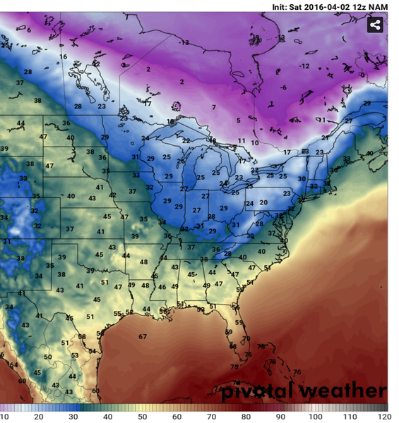
Here are the NAM forecast temperatures for Sunday morning with the freezing line near the I-95 corridor with temps falling rapidly into the 20s for the interior Northeast. Lake enhanced snow squalls will be possible throughout the snow belts of the Great Lakes region with instability in place and very cold air especially just above the surface. Multiple Alberta clipper storm systems will pass through the Northeast for the rest of the first week of April, which will only reinforce this very cold air mass through the period before a return to spring.
 Model imagery by: pivotalweather.com
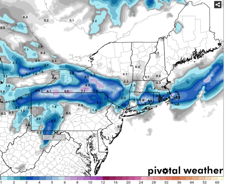
Snowfall totals forecast by the recently available 12z NAM shows a decent swath from Erie, PA area through just north of NYC and just inland from the coast from CT through RI and southeast MA. 6-8” of wet snow could fall across the higher elevations of western NY and even several inches could fall in the Hartford, CT area.
 Model imagery by: pivotalweather.com
WHAT A PATTERN! Be sure to secure loose items like lawn furniture, trash bins, etc. before the strong winds arrive tonight in the high wind warning and watch areas, and drive safe late tonight through Sunday morning as the sudden snow squalls arrive.
WarningAware provides a highly customizable service to monitor weather and emergency alerts for businesses and organizations.
Our service can monitor your locations for alerts and send intelligent notifications to both internal and external contacts.
Learn More