Severe Weather Threat Increasing Across Parts of the Southern Great Plains East of Dry Line!
Dr. Reed Timmer, Lead Meteorologist March 30, 2016
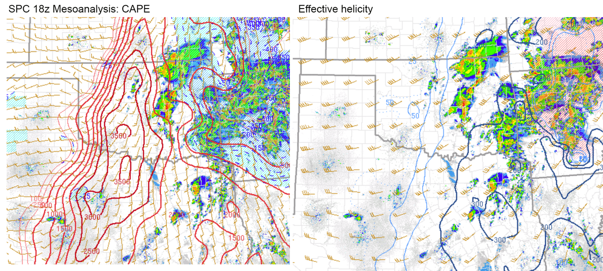
A severe weather threat is quickly materializing across parts of central OK, northwest TX into southern KS as the air mass east of a sharp dry line continues to destabilize. I’m currently in southern OK ahead of the dry line and am already seeing breaks in the clouds behind the initial band of convection that produced a few severe thunderstorm warnings in the OKC Metro earlier. Supercells are expected develop along the dry line to the west of I-35 with surface-based CAPE values rising through the 2000s J/kg, and will drop very large hail given the strong deep-layer wind shear and cold air aloft. A tornado threat may increase with any dominant supercell storms that can survive through evening. I’ve included the latest SPC Mesoanalysis plots from 18z for CAPE (left) and effective helicity (right) below. Low-level wind shear is currently lacking for any robust tornado potential early on, but the low-level jet is expected to increase across the warm sector east of the dry line closer to evening. Stay safe out there and stay tuned to local watches/warnings!
WarningAware provides a highly customizable service to monitor weather and emergency alerts for businesses and organizations.
Our service can monitor your locations for alerts and send intelligent notifications to both internal and external contacts.
Learn More