Major Snow Storm to the North, Severe Weather/Tornadoes to the South
Dr. Reed Timmer, Lead Meteorologist March 24, 2016
This major late season snowstorm is finally starting to wind down over the central Plains, but heavy snow and ice continue over parts of the Upper Great Lakes. Incredible storm total snow accumulation totals were received yesterday in the Colorado Foothills, with 2-3 feet of snow measured just west of Denver. As the storm system strengthened rapidly yesterday over the High Plains, widespread blizzard conditions were observed across northeast CO/southeast WY. So far, nearly a foot of snow has fallen across extreme southern MN where the deformation band pivoted.
Snowfall reports as of 8 am CDT:
- Jefferson County, CO: 31.6”
- Arapahoe County, CO: 25.0”
- Denver, CO: 12.5”
- Augusta, MN: 12.0”
- Rochester, MN: 10.5”
- LaCrosse, WI: 6.5”
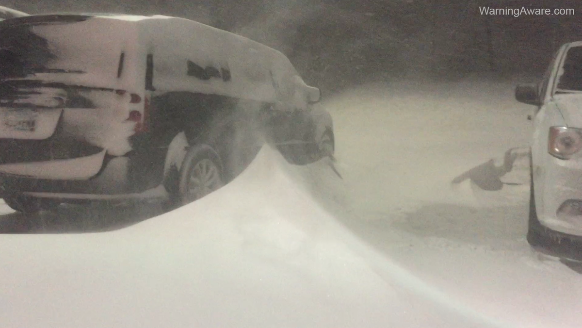
Here was my view from Albert Lea, MN this morning with 10-12” of snow and drifts several feet high causing major travel problems on I-35. The snow has finally ended here, but the clean-up will take awhile.
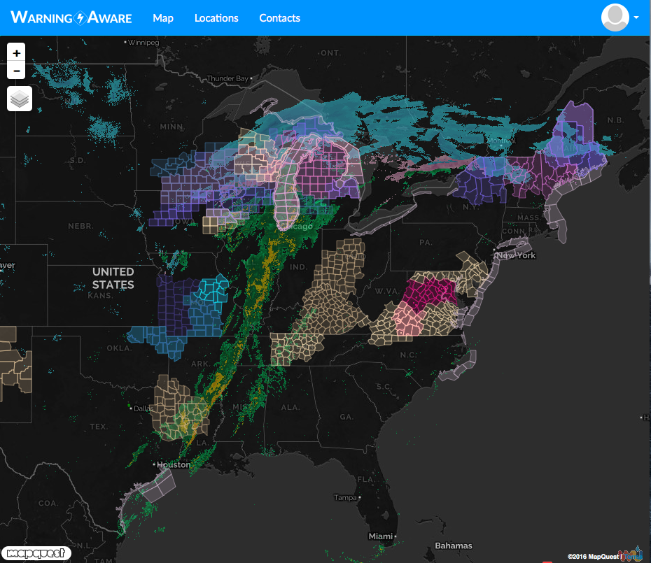
Winter storm warnings continue for parts of the central Plains through Upper Great Lakes regions, but the blizzard warning that was in effect last night for the Green Bay and Appleton, WI areas has been replaced with a winter storm warning as winds are not as strong as previously forecast. Check out the extreme weather alerts map below, which shows just how expansive are the impacts from this massive storm system. Now the focus shifts to the severe weather, isolated tornado threat across eastern MN, AL, and possibly southern TN depending on how far north the instability axis expands ahead of the advancing cold front.
The main threats from today’s severe weather will be supercell storms producing large hail and strong straight-line winds, and an isolated tornado cannot be ruled out, especially across central/southern AL and southeast MS between 5-9 pm. The 4 km NAM model forecasts below for CAPE (instability) and 0-1 km storm relative helicity (low-level wind shear) show the best overlap between these parameters over central/southern IA, but the magnitude of the wind shear is a bit marginal, so hopefully that will limit a strong tornado threat. Low-level hodographs are much more favorable for tornadoes from TN north, but the lack of moisture/instability that far north should prevent a tornado threat (at least northern TN). Supercells should initiate by late afternoon (4-5 pm) in southeast MS and move northeast across AL through evening.
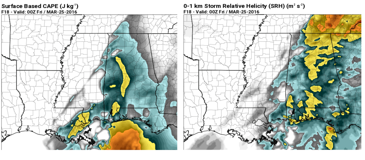 Model imagery by: pivotalweather.com
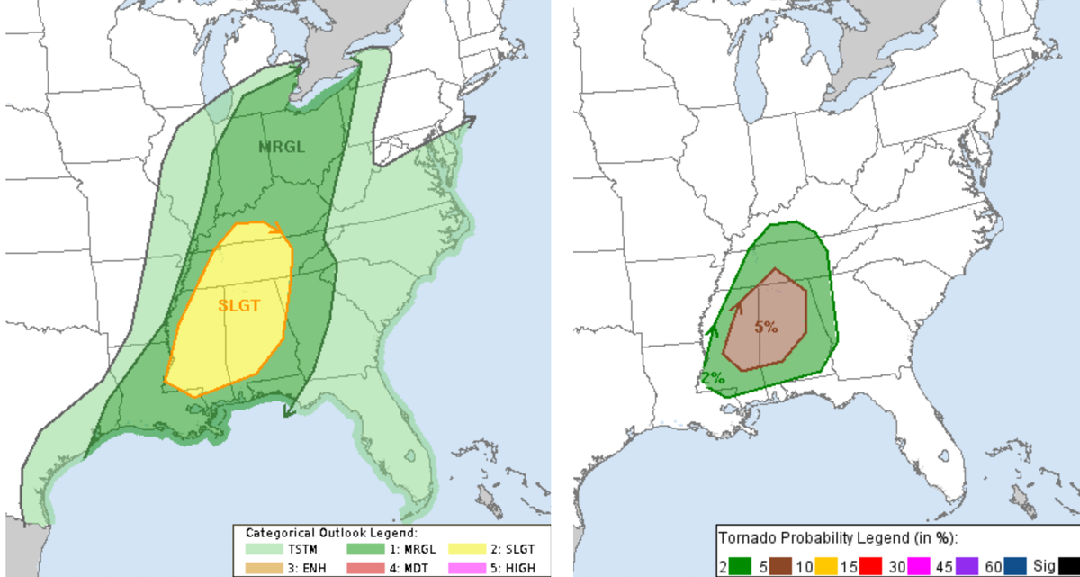
Here is the Storm Prediction Center (SPC) day 1 outlook:
WarningAware provides a highly customizable service to monitor weather and emergency alerts for businesses and organizations.
Our service can monitor your locations for alerts and send intelligent notifications to both internal and external contacts.
Learn More