Spring Snowstorm Targeting Southeast New England!
Dr. Reed Timmer, Lead Meteorologist March 20, 2016
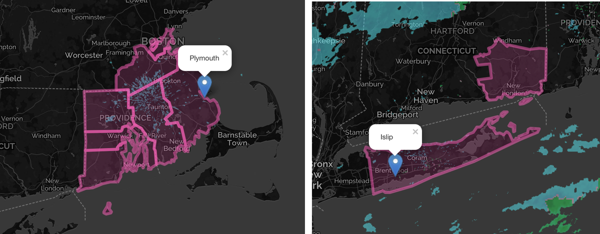
Winter storm warnings have been issued this morning for parts of southeast New England, including eastern Long Island, southeast Connecticut, all of Rhode Island, eastern Massachusetts, and Down East Maine. The heavy wet snow is expected to begin in and around the warning area from southwest to northeast late tonight, and continue through tomorrow afternoon in ME, with 6-10” possible in the warned area. With winds gusting up to 35 mph, power outages will be possible especially starting early Monday morning. The morning forecast models continue to support warning criteria snow across much of southeast New England, but model discrepancies and forecast uncertainty still exists, as is often the case with these dynamic coastal low pressure systems.
The models seemed to be trending toward a more westward track and stronger storm system through the day yesterday, with the 06z NAM even showing over a foot of snow in central Long Island and NYC even with several inches. This morning the models seem to be more in agreement with the heaviest band of snow setting up from eastern Long Island through just south of Boston, MA into Down East Maine. The snow should begin for NYC to Long Island this evening (around 7-9 pm), and around 10 pm to midnight for eastern MA.
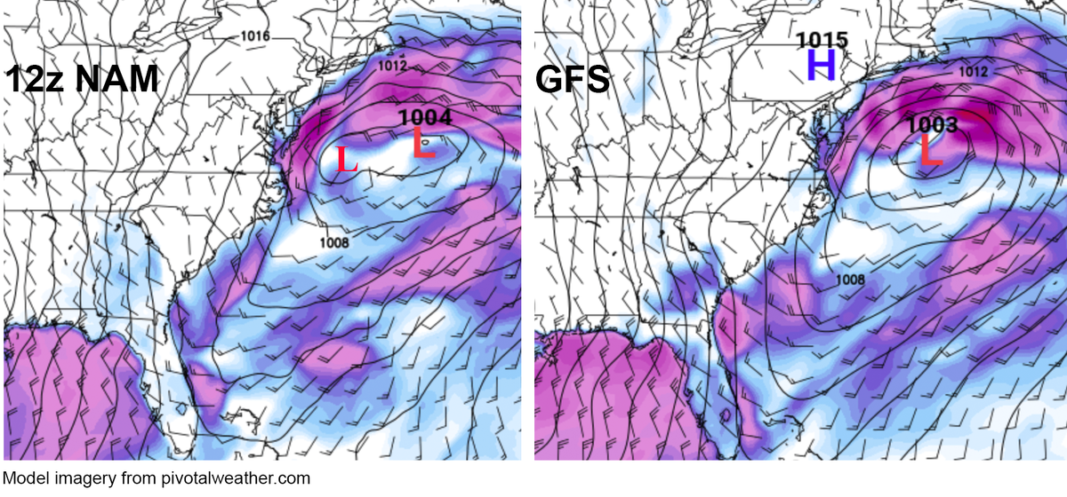
As has been the case with other nor’easter systems during the second half of winter, the NAM has hinted at a more elongated surface pressure field with two subtle low pressure centers gradually consolidating and intensifying into one main coastal low off of Cape Cod. Last night’s NAM solutions showed a stronger, more dominant western low pressure area just off the Mid-Atlantic Coast, with a more gradual consolidation into the dominant low to the northeast. The GFS and Euro models have indicated a single dominant coastal low with a track farther off the coast, but with a band of heavy snow setting up across the winter storm warning area. This morning, the NAM has trended slightly toward the GFS and Euro, so it looks like the NYC should only receive 1-2” of accumulation at most, with the heaviest snow eastern LI and to the northeast. However, should the western low pressure center become more dominant closer to the coast as was the case with earlier NAM model solutions, then NYC could see a quick several inches of snow as well, with Boston getting hammered with close to a foot. Either way, at least 6-10” can be expected for places like Montauk, NY, New London, CT, Providence, RI, and Boston, MA possibly Cape Cod depending on how much rain mixes in.
WarningAware provides a highly customizable service to monitor weather and emergency alerts for businesses and organizations.
Our service can monitor your locations for alerts and send intelligent notifications to both internal and external contacts.
Learn More