Severe Weather Recap
Dr. Reed Timmer, Lead Meteorologist March 16, 2016
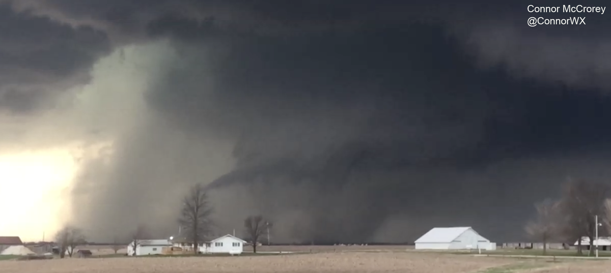
An active early spring storm season continues this year, with yet another tornado outbreak yesterday but this time extreme eastern Iowa and western Illinois. At least 3 long-track tornadic supercells tracked across this region from late afternoon through overnight, with confirmed tornadoes threatening major IL population centers like Peoria and Springfield. Here is a picture of one of the first tornadoes near Good Hope, IL taken by storm chaser Connor McCrorey (used with permission).
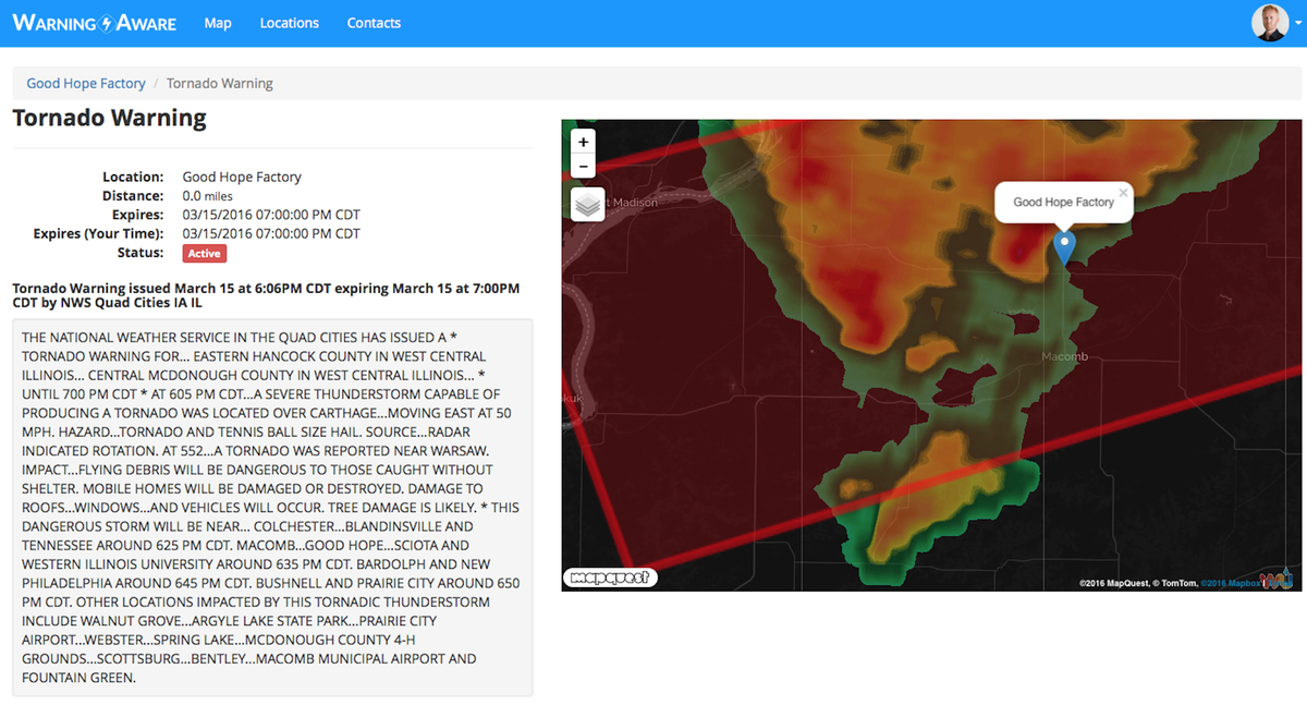
We set up a test alert location (Good Hope Factory) in the path of this storm and received the following alert from Warning Aware with confirmation of the ongoing tornado in the tornado warning text. Thankfully this dusty tornado under rapidly rotating wall cloud remained over open farm country and didn’t cause any problems.
Our forecast of the timing and location of the tornadoes was overall very accurate, with the first tornadoes of the day observed with the initial supercells near the IA/IL/MO border region. So far, 11 preliminary tornado reports have been posted by the Storm Prediction Center in this region, with 8 severe straight-line wind and 63 total hail reports. I suspect the final tornado count may increase slightly, as I did see some tornado warning text with confirmed tornadoes for supercells later that night well to the S/SW of Chicago. As I mentioned before this outbreak began, these early season cold upper-level lows are notorious tornado producers in Illinois even with any minor moisture limitations.
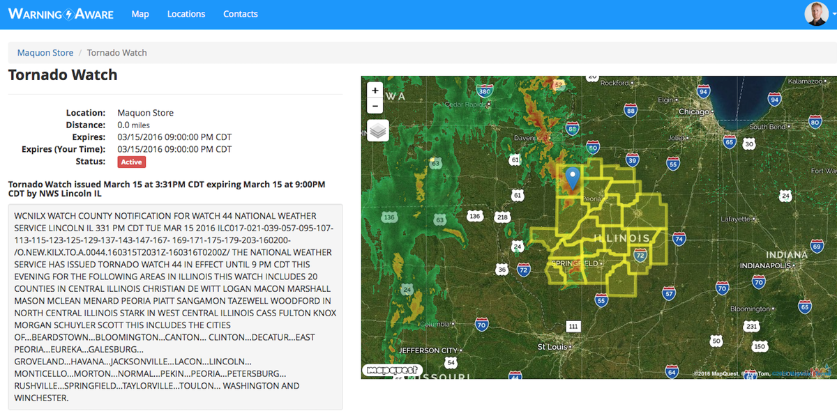
After the Good Hope tornado, this long-track supercell continued ENE, dropping tornadoes just north of Hanna City, IL in Peoria County, with significant damage to a church and large trees snapped 3 miles NNE of Trivoli. Storm chasers Bill Beach and Donovan Gruner observed power flashes in Peoria as this supercell moved through, but thankfully damage to the immediate Peoria area was relatively minor, and likely limited to rear flank downdraft winds. A tornado watch was issued for central IL including Peoria and Springfield by 330 pm CDT, several hours ahead of any severe weather.
Another more isolated supercell would develop to the WSW of Springfield, IL, and produce a few cone tornadoes near Loami, IL just outside of Downtown. Thankfully these tornadoes would avoid any major populated areas, but it was looking like a scary situation for Springfield as this monster storm was closing in. These supercells would gradually congeal into a line of severe storms as they moved toward the Chicago area, with a severe thunderstorm watch issued there until 3 pm (see below). However, the very cold waters of Lake Michigan would help to weaken this line of storms, sparing the immediate Chicago area of any damaging straight-line winds or hail.
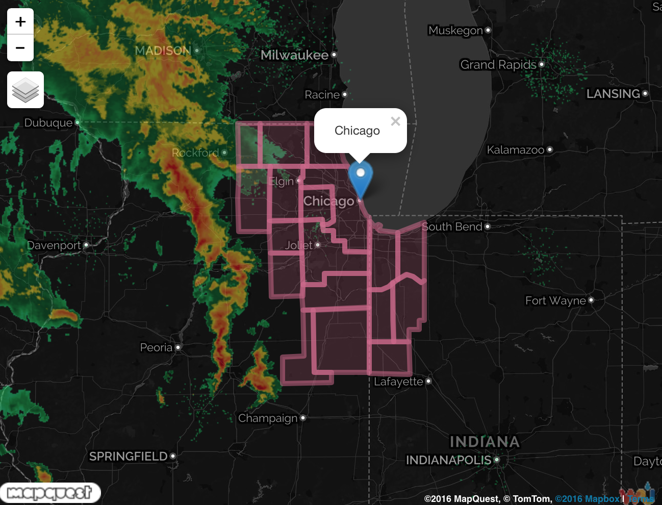
While Chicago again dodged a severe weather threat yesterday, a high wind warning was issued this morning on the backside of this strong storm system. Winds were forecast to gust over 58 mph and cause minor tree, power line, and even structural damage especially along the immediate Lake Michigan shoreline.
After yesterday, this makes two years in a row for Illinois starting off the severe weather season with a tornado outbreak, but thankfully yesterday’s event was not nearly as damaging as April 9 of 2015 in northern IL. On that day, violent EF4 tornadoes caused substantial damage in communities like Rochelle and Fairdale, as supercells formed along a sharp warm front in northern IL ahead of a much more potent storm system.
WarningAware provides a highly customizable service to monitor weather and emergency alerts for businesses and organizations.
Our service can monitor your locations for alerts and send intelligent notifications to both internal and external contacts.
Learn More