Significant Severe Weather, Including Tornadoes Likely in Western South Dakota!
Dr. Reed Timmer, Lead Meteorologist July 06, 2016
Significant severe weather likely across western SD, extreme eastern WY, possibly into northwest NE by late afternoon/evening today.
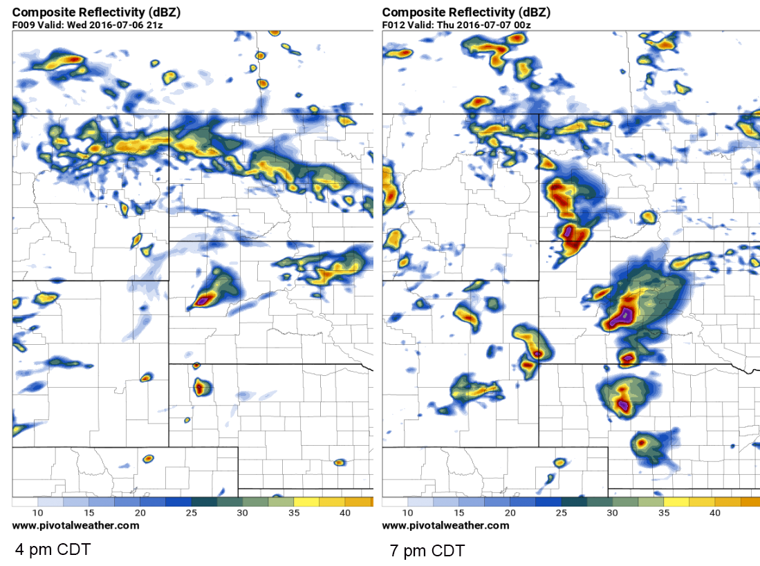
The greatest tornado threat will materialize after 3 or 4 pm CDT just east of the Black Hills, SD likely along the I-90 corridor through evening. Even a strong tornado or two will be possible given CAPE values in excess of 3000+ J/kg CAPE and 200+ m2/s2 effective helicities east of the Black Hills by 5 pm. I've included the latest SPC mesoanalysis forecast plots for surface-based CAPE/CIN and effective helicity for 3 pm and 5 pm CDT, respectively. The CAPE plot shows that the cap will erode around the Black Hills by 2-3 pm with convective initiation expected near the Black Hills and across the higher terrain of extreme eastern WY by the time. Storms will quickly become supercellular and move ESE toward the I-90 corridor by late afternoon/evening with monster hail, isolated tornado potential until the individual cells congeal into a squall line. Then, a widespread damaging straight-line wind event is expected through central/southern SD into central NE.

The most likely scenario will be for 1-2 long-lived supercells to develop on the east or northeast side of the Black Hills by 3 pm and start producing tornadoes by 4-5 pm near the I-90 corridor. By 7 pm (left panel), the coverage of storms should increase dramatically across western/central SD into western/central NE as the jet streak continues to eject over the warm sector. The coverage of storms as depicted here by the 4 km NAM is a little bit in question, with much higher confidence in the evolution of the SD supercells given the stronger cap and less upper-level forcing farther south.
Other severe weather with hail, heavy rain, and straight-line winds as the main threats is also possible to the east across eastern IA/northern central IL southern through the MO Bootheel region, and also high-based storms are likely as far south as the southern High Plains. It seems like July is going to be a much more active month for severe weather and tornadoes than June, with only around 60 tornadoes reported across the entire U.S. last month.
WarningAware provides a highly customizable service to monitor weather and emergency alerts for businesses and organizations.
Our service can monitor your locations for alerts and send intelligent notifications to both internal and external contacts.
Learn More