More Significant Severe Weather for Parts of the Southern Plains!
Dr. Reed Timmer, Lead Meteorologist May 24, 2016
The greatest tornado (moderate, 3/5) and large hail (high, 4/5) will be over southwest KS, extreme northwest OK into the northeast TX Panhandle, with forecast soundings showing potential for even strong tornadoes with locally enhanced wind shear along and north of boundary that will be near the KS/OK border. A jet streak will impinge on the warm sector by 4 pm, with supercell initiation expected near the triple point first in far southwest KS. Storms will then develop down the dry line into the Texas Panhandle with the greatest low level wind shear expected over the far northeast TX Panhandle into southwest KS between 5-9 pm as the low-level jet stream ramps up.
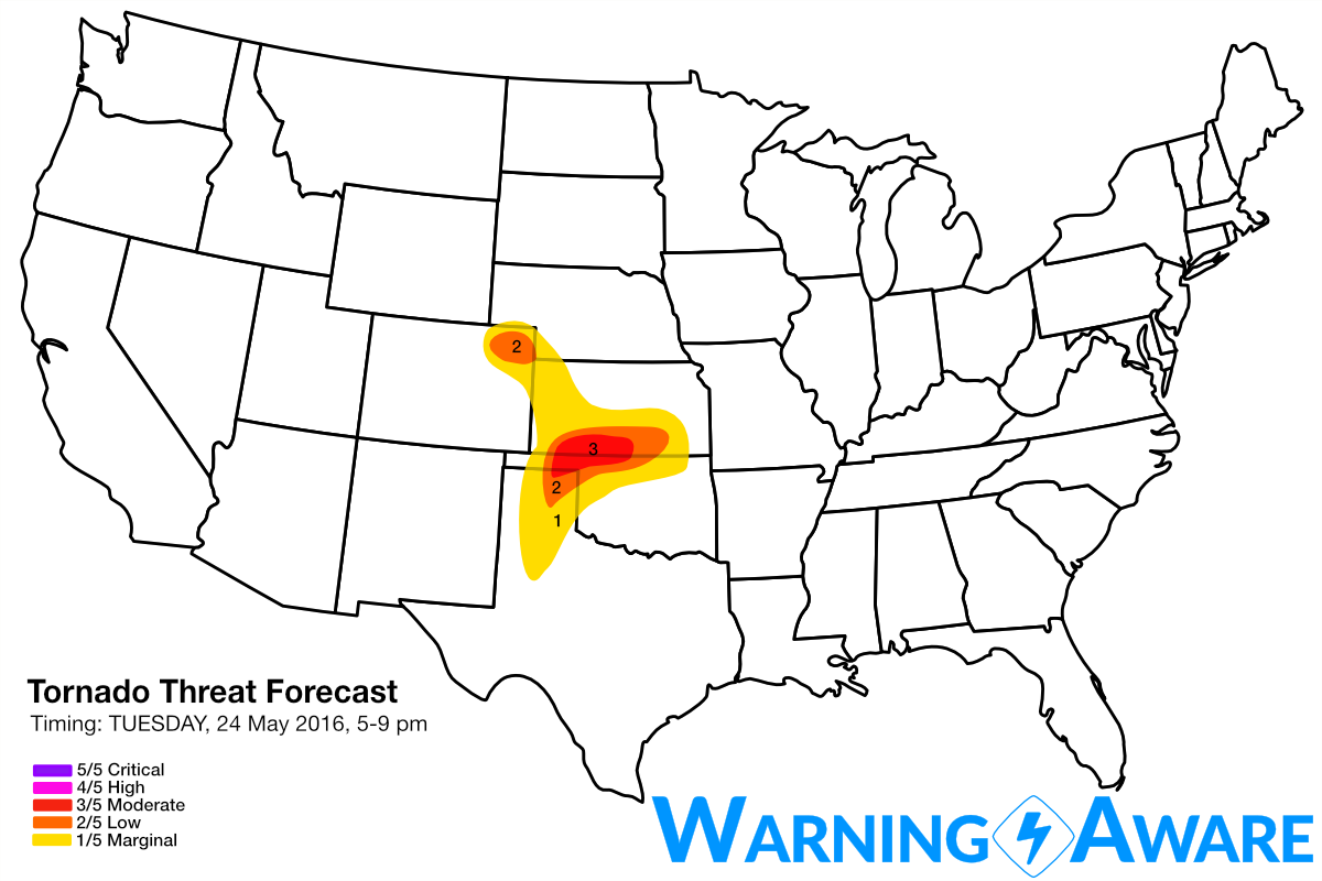

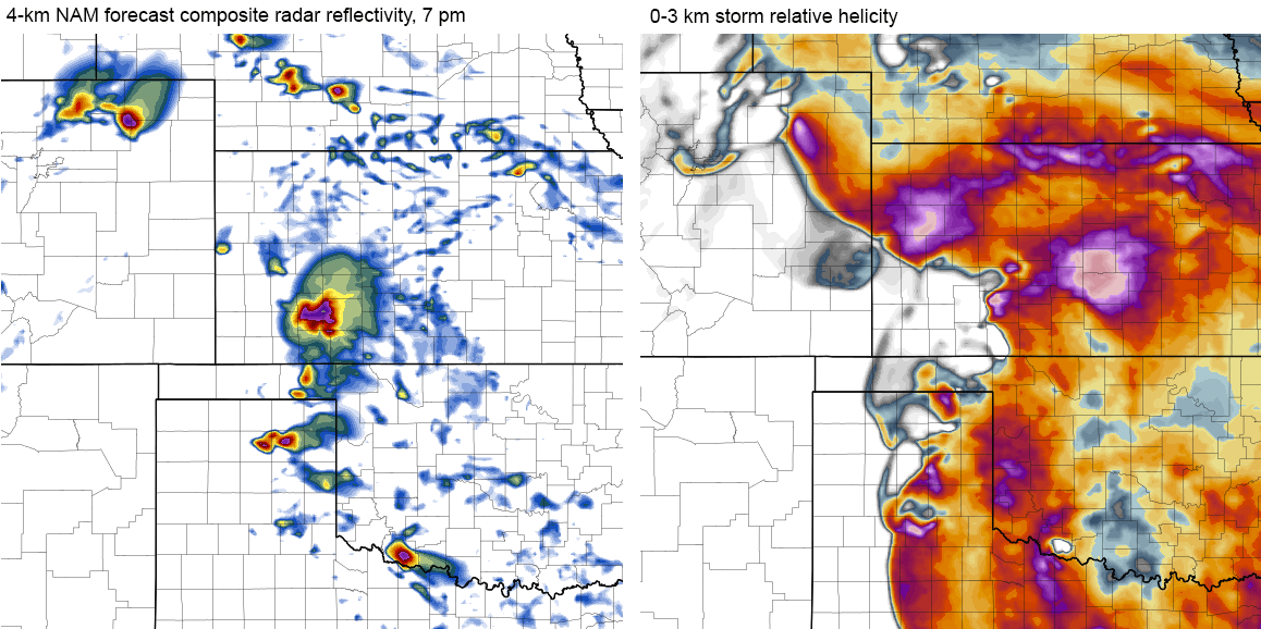
A secondary tornado threat will likely emerge over northeast Colorado as well by mid to late afternoon, with one or two long-track supercells expected there. Since expected storm coverage will be much lower than the warm sector in SW KS into the Panhandles, we've decided to stick with a 2/5 tornado and hail threat in northeast CO. However, I am confident that 1-2 tornadic supercells will evolve in northeast CO this afternoon, including near the Sterling area later on. Below are the latest 4 km NAM forecast composite reflectivity and 0-3 km storm relative helicity maps showing an environment RIPE for tornadoes by late afternoon/evening.
Forecast models are showing a relative quiet day on Wednesday but with extreme instability in place across southern KS, OK and northwest Texas, so any storms that can break the cap likely will be massive hail producers. Confidence is still high in a more significant, widespread severe weather and tornado outbreak for KS and OK on Thursday. More to come.
WarningAware provides a highly customizable service to monitor weather and emergency alerts for businesses and organizations.
Our service can monitor your locations for alerts and send intelligent notifications to both internal and external contacts.
Learn More