Greatest Severe Weather Threat for Western KS, North-Central MT by Late Afternoon/Evening!
Dr. Reed Timmer, Lead Meteorologist May 21, 2016
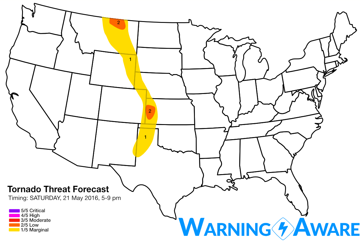
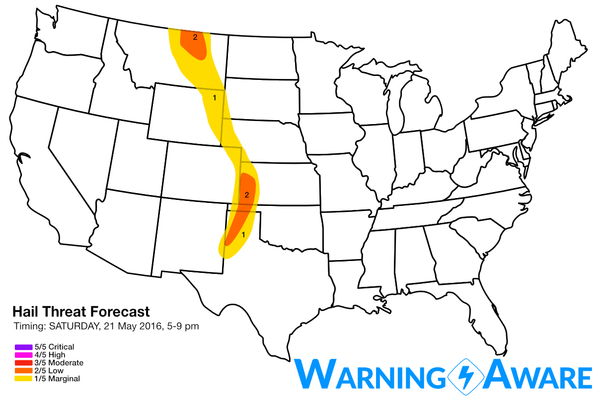
Here are the updated tornado and large hail threat maps for this afternoon and evening (Saturday, May 21, 2016), showing two primary areas of enhanced severe weather: (1) north-central Montana near the Fort Peck Lake area and (2) extreme western KS from near Goodland down through Garden City, KS area. Supercells producing large hail will be likely in these areas between about 5-8 pm, including even an isolated tornado threat, especially in the southern target. Will maintain a low or 2/5 category for these two modes of severe weather, including both tornadoes and large hail. Additional strong-to-severe multi-cellular and brief supercell structures are possible to the south through the OK and TX Panhandles, but wind shear and thermodynamic profiles do not yet appear conducive for a robust tornado threat just yet. Have decreased the probabilities for severe weather in the northeast CO target area as confidence in storm initiation there have decreased even further. I wouldn't be surprised to see a few low-precipitation (LP) supercells in eastern Wyoming by late afternoon, however.
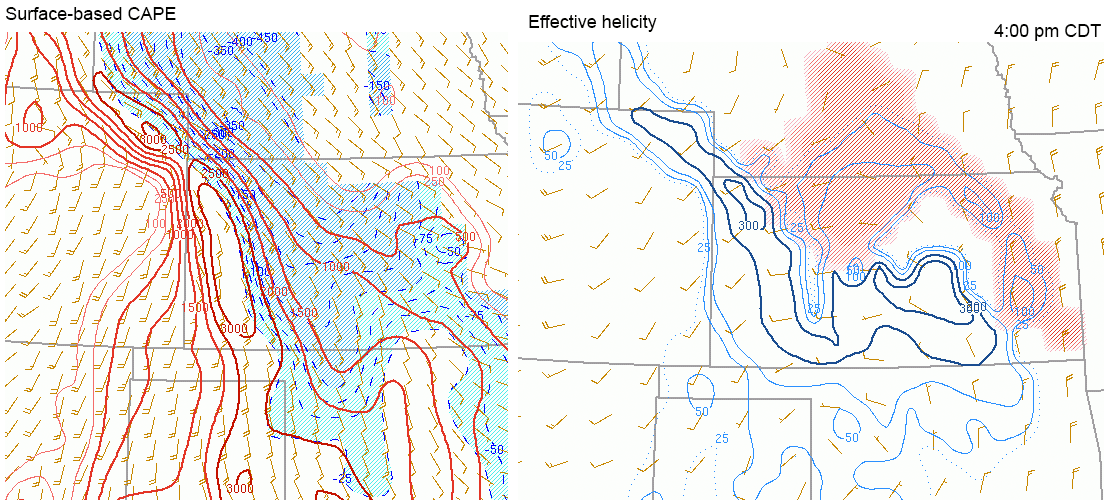
Focusing on the western KS tornado threat, I've included RAP analysis maps of surface-based CAPE and effective helicity forecast for 4 pm CDT from the Storm Prediction Center mesoanalysis page. This shows the convective inhibition eroding by 4 pm throughout western KS especially southwest of the NNW to SSE oriented moisture gradient. As shown by the effective helicity maps, low-level wind shear immediately along this boundary will be enhanced (200 m2/s2 and greater) by the relatively backed, southeasterly surface winds, co-located with strong instability and weak convective inhibition; and most importantly, dew points in the 60s and cloud based sufficiently low for tornadoes. I foresee storms initiating to the south of this boundary in the uncapped environment and drifting slowly north toward this moisture gradient. Any dominant storms that can survive cell mergers and earlier dry low-level environments could develop a tornado threat as they interact with the deeper moisture and stronger low-level wind shear to the north and east, especially just south of Goodland through the Garden City, KS area.
WarningAware provides a highly customizable service to monitor weather and emergency alerts for businesses and organizations.
Our service can monitor your locations for alerts and send intelligent notifications to both internal and external contacts.
Learn More